
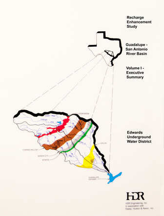
Recharge Enhancement Study Guadalupe-San Antonio River Basin Volume I-Executive Summary
| Author | HDR Engineering, Inc in association with Espey, Huston & Associates, Inc |
| Year | 1993 |
| Description | Development of the GSA Model to estimate recharge to the Edwards Aquifer from the San Antonio and Guadalupe River basins and effects of additional recharge structures |
| Publisher | HDR Engineering, Inc and Edwards Underground Water District |
| Location | Guadalupe River Basin, San Antonio River Basin |
| Cover | View Download |
| File | View Download |
| Summary |
|
The key objectives of the Guadalupe – San Antonio River Basin Recharge Enhancement Study are summarized as follows:
Conclusions Significant study findings and conclusions are as follows: The potential for recharge enhancement estimated in this report is a theoretical maximum and, on more detailed review, will likely be subject to significant reductions due to economic, environmental, structural, and political limitations. When analyzed as a part of a total regional water resources program, there may be other types of water resource projects which provide greater benefits than some of the projects identified in this report. Recharge of the Edwards Aquifer in the Guadalupe – San Antonio River Basin may be increased by an average of about 123,000 ac-ft/yr if all structural and operational projects identified in this report are implemented and all water rights are honored. This represents an increase of about 38.5 percent in the historical average recharge. Recharge during the 10-year drought period from 1947 through 1956 could be increased by about 66,300 ac-ft/yr or 43.3 percent of the historical average during this period. When the structural and operational programs identified are fully implemented, inflows to the Guadalupe Estuary will be reduced by an average of about 53,200 ac-ft/yr. The construction of only the structural program will reduce inflows by about 31,000 ac-ftjyr. These figures represent between 3.4 and 2.0 percent of the average annual flow of the Guadalupe and San Antonio Rivers into the Guadalupe Estuary. Estimates of recharge enhancement associated with the structural and operational programs are not very sensitive to the various aquifer pumpage/springflow scenarios or to the degree of water rights utilization. Recharge enhancement is typically limited by the volume of runoff reaching each site and the physical capability to impound and recharge that runoff. Potentially significant quantities of water may be available in the San Marcos River below the Blanco River confluence, in the Guadalupe River below the Comal River confluence, and in Canyon Lake for recharge enhancement or other uses. Theoretical maximum quantities of water available have been presented in this report for a range of assumptions as to Edwards Aquifer pumpage/springflow and utilization of existing water rights. Methods used in this study to calculate historical recharge to the Edwards Aquifer result in estimates that differ from previous estimates by the USGS. In particular, there are significant differences at Medina Lake and Diversion Lake (HDR estimates are lower), the area between the Medina River and Cibolo Creek (HDR estimates are higher), and the upper San Marcos River watershed (HDR estimates are higher). In addition, the methods used in this study show that significant recharge does occur in the Guadalupe River Basin where previous estimates by the USGS do not consider recharge in this basin. Recommendations The findings of this study indicate that recharge to the Edwards Aquifer may be substantially enhanced by the construction of additional recharge structures and/or changes in existing operational and institutional constraints. In order to determine whether these projects and/or operational changes are truly feasible and to quantify potential benefits to well yields and springflows, the following additional work is recommended: Information developed in this study should be analyzed as a part of a total regional water resources program which compares the relative merits of recharge enhancement to other water supply options. After the role of recharge is determined in the regional water resources planning effort, selected recharge projects should be carried forward for additional detailed study. The Texas Water Development Board model of the Edwards Aquifer should be recalibrated using the recharge values developed in this study and used to evaluate the various recharge options under consideration for the Nueces and Guadalupe – San Antonio River Basins to determine benefits to well yields and springflows. Significant numbers of additional streamgages and raingages should be added to the hydrologic data collection network to more accurately calculate recharge in ungagged areas and to significantly improve the accuracy of recharge estimates in areas directly over the recharge zone. A state-of-the-art recharge calculation methodology for the Edwards Aquifer should be developed which utilizes the additional streamgages and raingages and incorporates appropriate elements of the USGS and HDR procedures. It is expected that consideration of these state-of-the-art recharge estimates will result in significant improvement in aquifer model calibration. The TWDB Edwards Aquifer model and the surface water/recharge models of the Nueces and Guadalupe – San Antonio River Basins should be combined into one model to fully evaluate recharge enhancement options and to aid in the evaluation of various aquifer and surface water management alternatives. Benefit/cost analyses of recharge projects (and/or operational changes) should be performed in detailed studies considering economic, environmental, geological, institutional, and structural feasibility of individual projects as well as combinations of projects. Special hydrologic studies addressing the following specific items should be undertaken in support of improved recharge estimates: Field studies of Medina Lake and Diversion Lake to better understand and define relationships between reservoir levels and recharge and leakage rates; Field studies of water exchange rates between the Edwards Aquifer and the Guadalupe River downstream of Canyon Lake over a range of aquifer water levels; Refinement of firm yield estimates for Canyon Lake to include consideration of water delivery losses in conjunction with Edwards Aquifer pumpage/springflow scenarios and potential subordination of hydroelectric rights; Consideration of new geologic mapping of Bexar, Comal, and Hays Counties nearing completion by the USGS which should result in improved recharge zone definition and more accurate recharge basin drainage areas; and Investigation of the possibility of calculating historical total daily flow estimates (including flows which are not springflows) for the USGS San Marcos River springflow gage to provide more accurate historical recharge estimates for the upper San Marcos River watershed. This is similar to the procedure used at the USGS Comal River gage. |
Search for Documents
Advance Search
Explore EAA's Scientific Reports
- All Reports
- Hydrology and Hydrogeology
- History
- Groundwater Recharge, Recharge Zone
- Groundwater Movement
- Geomorphology and Caves
- Weather Modification
- Geology
- Water Use and Conservation
- Geochemistry
- Water Resources Planning and Management
- Floods and Drought
- Water Quality
- Climatology
- Surface Water / Groundwater Relationship
- Biology
- Springs, Groundwater Discharge
- Archaeology
- RZ Protection
- Aquifer Levels
- Remote Sensing
- Precipitation
- Overview Studies
- Modeling