| Title: |
Interconnection of the Trinity (Glen Rose) and Edwards Aquifers along the Balcones Fault Zone and Related Topics – Karst Conservation Initiative |
Description:
 |
Edwards Aquifer – Upper Glen Rose Aquifer Hydraulic Interaction |
Details
View
Download
|
| Title: |
Enhanced Characterization and Representation of Flow through Karst Aquifers-Phase II Revision 1 |
Description:
 |
Development and testing of the MODFLOW DCM version 2.0 model for karst aquifers
|
Details
View
Download
|
| Title: |
Structural mapping of the Edwards Aquifer in eastern and central Uvalde County, Texas, using seismic, well and outcrop data |
Description:
 |
Structural mapping of the Edwards Aquifer in eastern and central Uvalde County, Texas, using seismic, well and outcrop data. Work performed under contract with the EAA by Thomas E. Ewing, Frontera Exploration Consultants; May 24, 2005
|
Details
View
Download
|
| Title: |
Simulated Impacts Associated with the Cibolo Creek Transfers Using MODFLOW-NR and Senate Bill 3 Assumptions |
Description:
 |
Tests of MODFLOW-NR and Senate Bill 3 assumptions on springflow in the Edwards Aquifer Balcones Fault Zone San Antonio Segment
|
Details
View
Download
|
| Title: |
Evaluation of the Edwards Aquifer in Kinney and Uvalde Counties, Texas |
Description:
 |
Development of an updated conceptual model in the Edwards Aquifer for the Kinney County and Uvalde Pools and the relationship of the latter to the San Antonio Pool
|
Details
View
Download
|
| Title: |
Edwards Aquifer Authority Synoptic Water Level Program 1999-2004 Report |
Description:
 |
1999-2004 synoptic water level study
|
Details
View
Download
|
| Title: |
Tracing Groundwater Flowpaths in the Edwards Aquifer Recharge Zone, Panther Springs Creek Basin, Northern Bexar County, TX |
Description:
 |
Dye tracer tests in the Edwards Aquifer, Balcones Fault Zone, San Antonio Segment, Bexar County, Panther Springs Creek
|
Details
View
Download
|
| Title: |
Edwards Aquifer Authority Synoptic Water Level Program 2005-2009 Water Level Data |
Description:
 |
2005-2009 synoptic water level study
|
Details
View
Download
|
| Title: |
Tracing Groundwater Flowpaths in the Vicinity of San Marcos Springs, Texas |
Description:
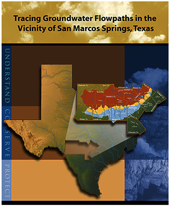 |
Tracer studies of the San Marcos Springs springshed from 2002 -2010
|
Details
View
Download
|
| Title: |
Structural Controls on the Edwards Aquifer/Trinity Aquifer Interface in the Camp Bullis Quadrangle, Texas |
Description:
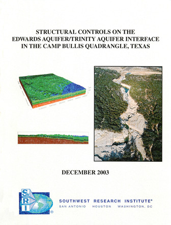 |
Structural analyses for geologic framework model of the area around the intersection of the Edwards and Trinity Aquifers
|
Details
View
Download
|
| Title: |
Conduits and Turbulent Flow in the Edwards Aquifer |
Description:
 |
Description of the Edwards Aquifer Balcones Fault Zone as a typical karst aquifer and recommendations for locations of conduits in the MODFLOW model
|
Details
View
Download
|
| Title: |
Refining the Conceptual Model for Flow in the Edwards Aquifer—Characterizing the Role of Fractures and Conduits in the Balcones Fault Zone Segment |
Description:
 |
Hydrogeologic study using existing data on role of fractures and conduits in groundwater flow in the recharge and artesian zones of the Edwards Aquifer Balcones Fault Zone
|
Details
View
Download
|
| Title: |
Geophysical Survey to Determine the Depth and Lateral Extent of the Leona Aquifer and Evaluation of Discharge Through the Leona River Floodplain, South of Uvalde, Texas |
Description:
 |
Determination of groundwater flow regime for the Leona Formation aquifer in the Leona River floodplain
|
Details
View
Download
|
| Title: |
1994 Review and Update of the Position of the Edwards Aquifer Freshwater/Saline-Water Interface from Uvalde to Kyle, Texas |
Description:
 |
1994 attempt to describe the location of the freshwater/saline-water interface accurately from Kyle to Uvalde, Texas
|
Details
View
Download
|
| Title: |
Defining the Edwards Aquifer Freshwater/Saline-Water Interface with Geophysical Logs and Measured Data (San Antonio to Kyle, Texas) |
Description:
 |
Analysis of geophysical logs to define the freshwater/saline water interface in the Edwards Aquifer between San Antonio and Kyle, TX. Note: Large-format versions of the plates for this report are available in a companion document.
|
Details
View
Download
|
| Title: |
Hydrogeologic Framework and Geochemistry of the Edwards Aquifer Saline-Water Zone, South-Central Texas |
Description:
 |
Geochemical study of the Edwards Aquifer saline zone in relation to location of downdip and geological faults
|
Details
View
Download
|
| Title: |
Investigation of the Fresh/Saline Water Interface in the Edwards Aquifer in New Braunfels and San Marcos, Texas Executive Summary |
Description:
 |
Attempts to define the freshwater/saline water boundary and its movement in the New Braunfels/San Marcos area from monitoring well data.
|
Details
View
Download
|
| Title: |
Regional Distribution of Permeability in the Edwards Aquifer |
Description:
 |
Quantitative distribution of various factors controlling permeability and analysis of geographic and geologic relationships in the Edwards aquifer. Note: Large-format versions of the plates for this report are available in a companion document.
|
Details
View
Download
|
| Title: |
The Edwards Aquifer Extremely Productive, but… |
Description:
 |
Semi-technical description of the Edwards aquifer and considerations for its use and preservation for the general public and policy-makers
|
Details
View
Download
|
| Title: |
Using Geophysical Logs in the Edwards Aquifer to Estimate Water Quality Along the Freshwater/Saline-Water Interface (Uvalde to San Antonio, Texas) |
Description:
 |
Note: Large-format versions of the plates for this report are available in a companion document. Analysis of geophysical logs and well data to redefine the boundary of the freshwater/saline interface in the Edwards Aquifer Balcones Fault Zone San Antonio Segment.
|
Details
View
Download
|
| Title: |
Edwards/Glen Rose Hydrologic Communication, San Antonio Region, Texas |
Description:
 |
Hydrogeological and modeling study of transmissivity between the Glen Rose and Edwards aquifers in the Cibolo Creek Basin and Guadalupe River
|
Details
View
Download
|
| Title: |
Report on the Edwards Aquifer San Antonio Region, Texas |
Description:
 |
Review of geology, hydrogeology, recharge and pumpage of the Edwards Aquifer, Balcones Fault Zone, San Antonio Segment Note: This report is included for its historical value and may have been replaced by more recent studies.
|
Details
View
Download
|
| Title: |
A Statistical Study of the Hydrological Character of the Edwards Aquifer |
Description:
 |
Statistical analysis of surface and groundwater levels from October 1998 storm event
|
Details
View
Download
|
| Title: |
Edwards Aquifer Parameter Estimation Project: Final Report |
Description:
 |
Revision 3 of the hydraulic conductivity model using spatial statistics and various hydrological data calibrated to steady-state hydraulic head measurements and partially calibrated to steady-state spring discharges, for manual calibration of the model and as a basis for fully automated calibrations. This study is included for historical value and may have been supplanted by more recent ones.
|
Details
View
Download
|
| Title: |
Conceptualization and Simulation of the Edwards Aquifer, San Antonio Region, Texas |
Description:
 |
A new ground-flow model for the San Antonio and Barton Springs segments in the San Antonio region. Note: this document is included for its historical value and may have been replace by more recent updates.
|
Details
View
Download
|
| Title: |
South Medina County Observation Well Project |
Description:
 |
Drilling and evaluation of a new test well in South Medina County to refine the location of the freshwater / saline water interface in the Edwards Aquifer interface between San Antonio and Uvalde, Texas
|
Details
View
Download
|
| Title: |
Drilling, Construction and Testing of Monitor Wells for the Edwards Aquifer Bad Water Line Experiment |
Description:
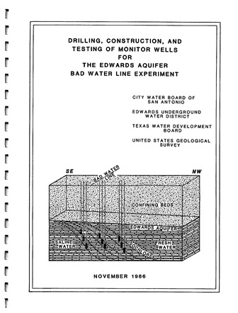 |
Study of the fresh water-saline interface using new monitoring wells in the San Antonio Artesia Water Field. Note: This report is included for its historical value and may no longer reflect current conditions.
|
Details
View
Download
|
| Title: |
Potential for Updip Movement of Salinewater in the Edwards Aquifer, San Antonio, Texas |
Description:
 |
Modeling the shift of the freshwater-saline water interface under various conditions over a 10-year period
|
Details
View
Download
|
| Title: |
Environmental Tritium in the Edwards Aquifer Central Texas 1963-71 |
Description:
 |
Analysis of tritium in 50 wells and springs in the San Antonio area
|
Details
View
Download
|
| Title: |
Edwards Aquifer Ground-Water Divides Assessment, San Antonio Region, Texas |
Description:
 |
Hydrogeologic study on location of groundwater divides in Hays and Kinney Counties
|
Details
View
Download
|
| Title: |
Investigation of the Fresh/Saline Water Interface in the Edwards Aquifer in New Braunfels and San Marcos, Texas – Appendices |
Description:
 |
Attempts to define the freshwater/saline water boundary and its movement in the New Braunfels/San Marcos area from monitoring well data - Appendices
|
Details
View
Download
|
| Title: |
Analysis of Data from Test-Well Sites along the Downdip Limit of Freshwater in the Edwards Aquifer, San Antonio, Texas, 1985-87 |
Description:
 |
Geochemical and hydrochemical study of the Edwards Aquifer downdip area and saline-freshwater interface in the San Antonio area
|
Details
View
Download
|
| Title: |
Bad Water Line Transect Pumping Test at San Antonio City Water Board’s Artesia Station, March 25, 1987 |
Description:
 |
Pumping test at the San Antonio Artesia Station to determine stability and recovery of wells from stress. Note: Page-size and large-format plates are at the end of the document.
|
Details
View
Download
|
| Title: |
Investigation of the Fresh/Saline Water Interface in the Edwards Aquifer in New Braunfels and San Marcos, Texas – Report |
Description:
 |
Attempts to define the freshwater/saline water boundary and its movement in the New Braunfels/San Marcos area from monitoring well data - Report
|
Details
View
Download
|
| Title: |
Measuring Floodplain Hydraulics of Seco Creek and Medina River Where They Overlie the Edwards Aquifer – Final Report |
Description:
 |
Study of the hydraulic relationships between Seco Creek, the Medina River, and the Edwards Aquifer
|
Details
View
Download
|
| Title: |
Structural Controls on the Edwards Aquifer/Trinity Aquifer Interface in the Helotes Quadrangle, Texas |
Description:
 |
Structural analyses for geologic framework model of the Helotes Quadrangle around the intersection of the Edwards and Trinity Aquifers
|
Details
View
Download
|
| Title: |
Water-Budget Analysis of Medina and Diversion Lakes and the Medina/Diversion Lake System, with Estimated Recharge to Edwards Aquifer, San Antonio, Texas |
Description:
 |
Water-budget analysis for Medina and related lakes including recharge in the Edwards Aquifer from 1995-2002
|
Details
View
Download
|
| Title: |
Defining the Edwards Aquifer Freshwater/Saline-Water Interface with Geophysical Logs and Measured Data (San Antonio to Kyle, Texas) – Plates |
Description:
 |
Analysis of geophysical logs to define the freshwater/saline water interface in the Edwards Aquifer between San Antonio and Kyle, TX. Note: These are large-format versions of the plates for the companion document.
|
Details
View
Download
|
| Title: |
Regional Distribution of Permeability in the Edwards Aquifer – Plates |
Description:
 |
Large-format versions of the plates for Regional Distribution of Permeability in the Edwards Aquifer. See companion document.
|
Details
View
Download
|
| Title: |
Using Geophysical Logs in the Edwards Aquifer to Estimate Water Quality Along the Freshwater/Saline-Water Interface (Uvalde to San Antonio, Texas) – Plates |
Description:
 |
Full-size plates from Using Geophysical Logs in the Edwards Aquifer to Estimate Water Quality Along the Freshwater/Saline-Water Interface (Uvalde to San Antonio, Texas). See companion document.
|
Details
View
Download
|
| Title: |
Water resources of the Edwards Aquifer Region [Infographic] |
Description:
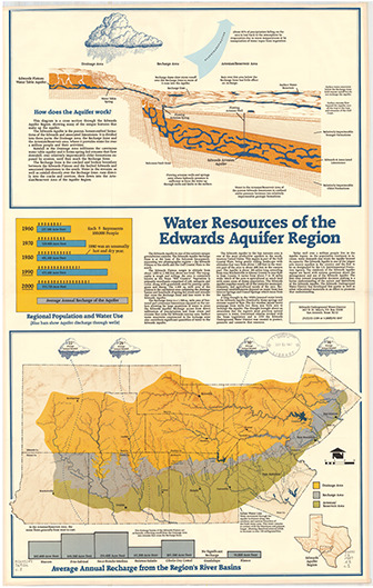 |
Infographic and map showing structure, discharge and recharge of the Edwards Aquifer. Scale ca. 1:500,000. Note: contains both letter-size and large-format versions.
|
Details
View
Download
|
| Title: |
The Edwards Underground Reservoir [Trifold Brochure and Map] |
Description:
 |
Map and summary of the Edwards Aquifer and Edwards Underground Water District. Note: this information is no longer current but is included for historical value.
|
Details
View
Download
|
| Title: |
1994 Review and Update of the Position of the Edwards Aquifer Freshwater/Saline-Water Interface from Uvalde to Kyle, Texas-Plates |
Description:
 |
Large-format plates for 1994 Review and Update of the Position of the Edwards Aquifer Freshwater/Saline-Water Interface from Uvalde to Kyle, Texas. See companion document.
|
Details
View
Download
|
| Title: |
Water Quality Trends Analysis of the San Antonio Segment, Balcones Fault Zone Edwards Aquifer, Texas |
Description:
 |
Collection and analysis of thousands of groundwater, surface water, and spring water samples to evaluate water quality in the San Antonio segment of the Balcones Fault Zone Edwards Aquifer of south central Texas.
|
Details
View
Download
|
| Title: |
Edwards Aquifer Authority Hydrologic Data Report for 2013 |
Description:
 |
Annual report for 2013 on recharge, discharge, water levels and water quality in the Edwards Aquifer San Antonio Region
|
Details
View
Download
|
| Title: |
DEVELOPMENT OF A FINITE-ELEMENT METHOD GROUNDWATER FLOW MODEL FOR THE EDWARDS AQUIFER |
Description:
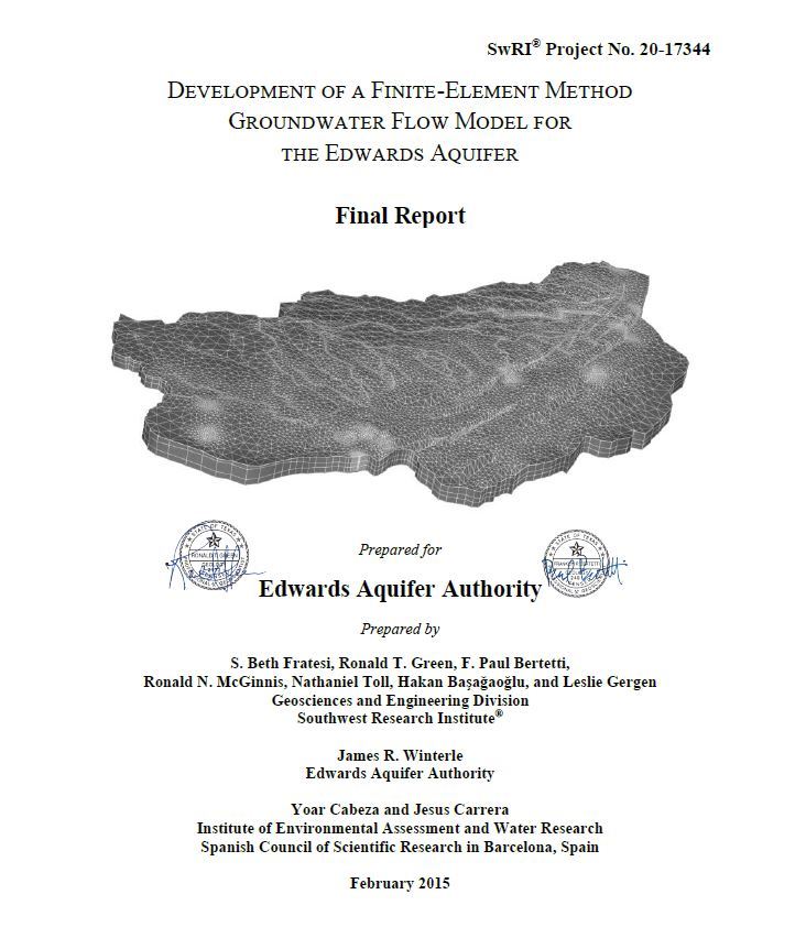 |
Attributes of the alternative model that set it conceptually independent from the 2004 MODFLOW model are: Inclusion of the Contributing Zone Recharge is calculated directly from precipitation and is not prescribed at the upgradient side of the Recharge Zone Western boundary is refined to better define the Kinney Pool The Contributing and Recharge Zones are characterized by three layers Distinct conduits are included in the Confined Zone The alternative model employs a finite-element formulation instead of the finite-difference formulation used in the 2004 MODFLOW model
|
Details
View
Download
|
| Title: |
Appendix C of Edwards Aquifer Authority Hydrologic Data Report for 2014 |
Description:
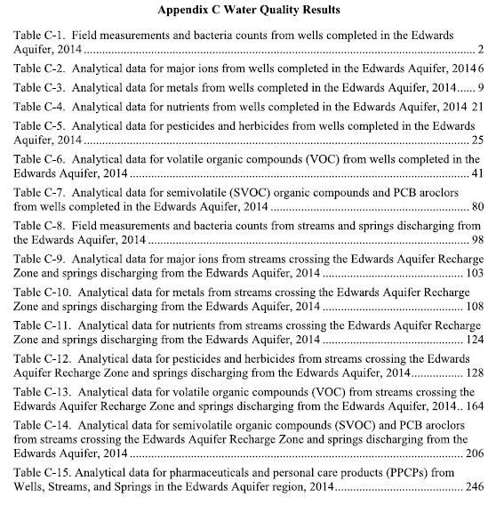 |
Appendix C of Edwards Aquifer Authority Hydrologic Data Report for 2014 Year 2014 Water Quality Data
|
Details
View
Download
|
| Title: |
Tracing Groundwater Flowpaths in Kinney County, Texas |
Description:
 |
This report presents the findings of a groundwater flowpath investigation in Kinney County, Texas, performed by the Edwards Aquifer Authority between 2007 and 2012.
|
Details
View
Download
|
| Title: |
Augmenting Groundwater Recharge Through Brush Control: A Feasibility Study—Phase II |
Description:
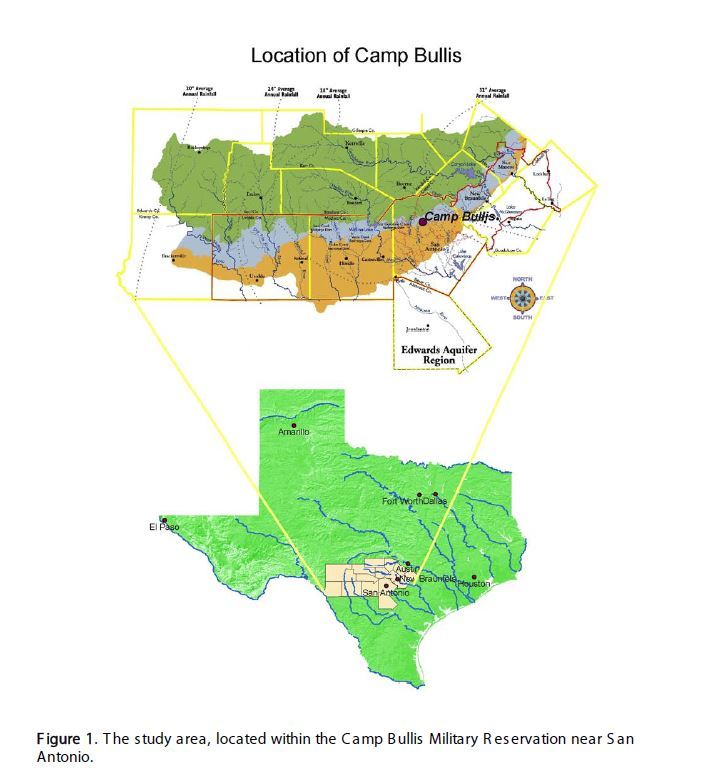 |
This report summarizes the findings of a 5-year (November 2004–December 2009) investigation of the water dynamics at two sites overlying shallow caves within the Camp Bullis facility in northern Bexar County, Texas. The results of the first phase of this study (November 2004–November 2007) were documented in the Phase I report (Wilcox 2008). In this Phase II report, we summarize the results from the entire study period, focusing on rainfall, cave recharge, and the rainfall simulation experiments conducted during Phase II.
|
Details
View
Download
|
| Title: |
Re-Conceptualizing the Edwards Aquifer Authority Recharge Program: Staff Recommendations to Optimize and Protect the Edwards Aquifer |
Description:
 |
Recharge is defined in the EAA Act as: Increasing the supply of water to the aquifer by naturally occurring channels or artificial means. Based on this definition, the EAA recharge program previously consisted of four recharge dams initially sponsored by the EUWD and Medina County Commissioners Court until calendar year 2004, when participation in the regional Precipitation Enhancement Program (PEP) was added to the program.
|
Details
View
Download
|
| Title: |
Field and Laboratory Tests of Passive Sampling Techniques |
Description:
 |
One of the objectives of the study was to compare the results between the five urban wells and the two rural wells. Only one rural sample contained PCE, and all the other detections were fuel-related compounds, in contrast to the frequent detections of PCE in the urban wells.
|
Details
View
Download
|
