
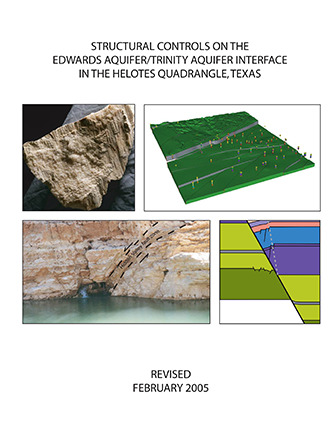
Structural Controls on the Edwards Aquifer/Trinity Aquifer Interface in the Helotes Quadrangle, Texas
| Author | DA Ferrill, DW Sims, N Franklin, AP Morris, DJ Waiting |
| Year | 2005 |
| Description | Structural analyses for geologic framework model of the Helotes Quadrangle around the intersection of the Edwards and Trinity Aquifers |
| Publisher | CNWRA, Southwest Research Institute® |
| Location | Edwards Aquifer, Balcones Fault Zone, San Antonio Segment, Trinity Aquifer, Bexar County |
| Cover | View Download |
| File | View Download |
| Summary |
|
The purpose of this study was to generate a three-dimensional geologic model of the Edwards Aquifer and Trinity Aquifer in the area of the Helotes Quadrangle and to assess the potential for hydraulic communication across the interface between the two aquifers. the study was completed in February 2005 by Southwest research Institute, San Antonio, Texas. [Executive Summary] Results of the project show the aquifer architecture throughout the study area, the location and interpreted geometry of the most important mapped faults in the study area, and the deformation mechanisms and deformation style in fault zones in the rocks of both the Edwards and Trinity Aquifers. The three-dimensional geologic framework model of the Helotes area reveals: (i) juxtaposition of permeable and relatively impermeable hydrogeologic units, (ii) structural thinning of the Edwards and Trinity Aquifers, (iii) potential for cross-fault communication between the Edwards and Trinity Aquifers, (iv) faults expressed on the surface as potential infiltration pathways, and (v) maximum offset concentrated along a small number (two or three) faults. This information, along with an understanding of fault zone deformation mechanisms and the role of fault zones as barriers or conduits, can assist in locating environmentally sensitive areas. It is useful for aquifer water flow path studies and contributes to the identification of areas where communication between the Trinity and Edwards Aquifers is suspected. In this geologic framework model, the Edwards and Trinity Aquifers and associated confining layers are subdivided into 12 stratigraphic units which are offset by a network of 30 faults. Vertical offset (fault throw) ranges from near zero to an approximate maximum of 178 meters (584 ft). Displacement sense is normal, commonly down to the southeast, and lateral throw gradients are generally small (0.002 to 0.015), although locally may be as high as 0.03. In map view, fault blocks are elongate, with the long axis commonly oriented NE-SW. Maximum offset is concentrated along two major fault systems; one fault, the Haby Crossing fault, has a maximum throw of about 178 m (584 ft) and juxtaposes virtually the entire Edwards Group stratigraphic section with rocks of the Glen Rose Formation beneath the City of Helotes. The Diversion Lake fault cuts across the NW corner of the Helotes Quadrangle, and has amaximum throw of 68 m (223 ft) within the quadrangle area. In general, normal faults of all displacements decrease the effective aquifer thickness. This structural thinning of aquifer layers can cause flow constrictions, which in turn may divert flow and cause fluctuations in the local water table from fault block to fault block. Areas of such flow constrictions can be identified using a map of fault throw distribution; constriction is likely greatest where fault throw is greatest. The large displacement on the Haby Crossing fault within the Helotes quadrangle may be significant for direct communication between the Edwards Group and Glen Rose Formation in this area. Also important, this large displacement on a single fault is responsible for dropping the Edwards Aquifer from hilltop exposures north of the Haby Crossing fault, to mostly buried (confined) on the south side. Consequently, this large-displacement fault results in a local narrowing of the area designated as Edwards Aquifer recharge zone. 3DStress™ analyses of measured faults and regional stratigraphic thicknesses based on published maps yield a stress system during faulting of: vertical effective stress = 15 MPa; minimum horizontal effective stress (F3′) = 4 MPa with an azimuth of 150°; and an intermediate principal effective stress = 9.5 MPa. When applied to the fault surfaces exported from the three-dimensional geologic framework model, this stress tensor indicates that the dominant, NE-SW striking faults experience high slip tendencies and are well oriented to have accommodated regional strains developed within the inferred stress system. In addition to experiencing high slip tendencies in the inferred stress system, the predominant faults are also subject to high dilation tendencies; this is especially true within the Edwards Aquifer section because these faults tend to have steeper dips than those within the Glen Rose Formation, and hence experience greater dilation tendencies. This combination of high slip and dilation tendencies implies that the major faults could have been effective fluid transmission pathways at the time of faulting. If a similar stress system were extant today, the faults would be in favorable orientations for enhanced fluid transmissivity. Fault block deformation calculated using cutoff lines generated from the three-dimensional geologic framework model results in cutoff line elongations that rarely exceed 2 percent (positive or negative). Although these small cutoff elongations reflect generally low displacement gradients, faults within the Helotes area exhibit higher cutoff strains along more fault length than either the Castle Hills or Camp Bullis areas. At the scale of the three-dimensional model, competent units exhibit gentle dips, which is consistent with relatively rapid lateral and vertical fault propagation, until intersection with other faults occurs (laterally) or intersection with a weaker mechanical layer occurs. The overall lack of steep lateral displacement gradients suggests rapid fault propagation with respect to the rate of displacementaccumulation on the faults, although there are locations in which steeper lateral gradients have developed. Field work reveals interesting contrasts between faults in the Edwards and Trinity Aquifers. Faults with displacements of 5 m (16 ft) to tens of meters in the Glen Rose Formation (Trinity Aquifer) commonly have wide damage zones, on the order of meters, within which small faults, rotated fault blocks, and smear of clay shale beds (if present) are common. By contrast fault zones with displacements of 5 m (16 ft) to tens of meters in the Edwards Group limestones typically have numerous associated small faults, but associated block rotation and bed tilting are rare. This characteristic difference in structural style between the Edwards Group limestones and the Glen Rose Formation appears to be related to lithologic differences and the resulting differences in mechanical behavior of the two stratigraphic sections. The Glen Rose Formation contains both competent massive limestone beds and incompetent argillaceous limestone and shale beds. Incompetent beds tend to arrest fault propagation during fault growth. Consequently, with increasing fault displacement, fault tips (terminations) episodically propagate. Continued displacement on a fault with an arrested fault tipline will produce fault tipline folding and associated local deformation such as complex small-scale faulting. Resulting fault damage zones are quite complex and variable along a fault, and the complexity of faulting is related to the structural position (including displacement magnitude) and the associated mechanical stratigraphy. Permeability in fault zones and fault blocks is strongly influenced by deformation styles in different mechanical layers as well as the deformation progression with increasing fault displacement. The large fault surfaces that cut multiple layers depicted in the Helotes geologic framework model provide potential pathways for both vertical and lateral movement of water and hydraulic communicationbetween aquifers. These fault surfaces along with localized zones of relatively intense small-scale faulting and extension fracturing, and limestone solution (karst conduit formation) provide likelycommunication pathways between the Edwards and Trinity Aquifers. The structural analyses presented in this report provide the basis for more detailed investigations of groundwater levels, multiwell pumping (drawdown) tests, tracer studies, and geochemical investigations to further investigate potential groundwater communication between the Edwards and Trinity Aquifers in the Helotes Quadrangle. |
Search for Documents
Advance Search
Explore EAA's Scientific Reports
- All Reports
- Precipitation
- Overview Studies
- Modeling
- Hydrology and Hydrogeology
- History
- Groundwater Recharge, Recharge Zone
- Groundwater Movement
- Geomorphology and Caves
- Weather Modification
- Geology
- Water Use and Conservation
- Geochemistry
- Water Resources Planning and Management
- Floods and Drought
- Water Quality
- Climatology
- Surface Water / Groundwater Relationship
- Biology
- Springs, Groundwater Discharge
- Archaeology
- RZ Protection
- Aquifer Levels
- Remote Sensing