

logo
  • Online Portal
  • Online Payments
  • News
  • Calendar
  • Careers
  • Conservancy
Search Icon
  • EAA 30th Anniversary
  • Groundwater Users
  • Aquifer Science
  • Aquifer Protection
  • Education
  • About
  • Edwards Aquifer
    Habitat Conservation Plan
  • Manage My Groundwater Permit
  • Online Payments
  • Online Portal
  • Groundwater Conservation Plan (GCP)
  • Groundwater Conservation Grants
  • VISPO (Voluntary Irrigation Suspension Program Option)
  • ASR (Aquifer Storage and Recovery)
  • Compliance & Enforcement
  • Groundwater Use Reporting
    • How to Read Your Meter
    • Automated Meter Reading
    • Meter Accuracy Verification
    • Meter Matters App
  • Transfer, Sell, Lease Water Rights
    • Permit Holders List
    • Buyers & Lessees List
    • Sellers & Lessors List
  • Critical Period/Drought Management (CPM)
    • Critical Period Calculator
    • Critical Period Forecast Calculator
    • Critical Period Online Usage Reporting System
  • Wells
    • Well Registration and Updates
    • Well Maintenance & Inspection
    • Well Closure Procedures & Construction
    • Abandoned Well Program
  • Managing The Edwards Aquifer
  • About The Edwards Aquifer
  • Research
    • Projects
    • Science & Data Document Library
    • Modeling
  • Sustainability
    • Conservation Easements
    • Field Research Park
  • Maps & GIS
    • Regulatory Zone Maps
    • Shapefiles
    • Service Level Agreement – GIS
    • Calibrated Rain Maps
    • ArcGIS Online
  • Enhancing The Edwards Aquifer
  • Environmental Data Portal
  • Precipitation Enhancement Program
  • Abandoned Well Program
    • Report An Abandoned Well
  • Groundwater Protection
    • Edwards Aquifer State Resource Concern (EASRC)
  • First Responder Login
  • Management of Regulated Substance Storage
    • Facility Registration, Storage & Planning
    • Aboveground/Underground Storage Tanks
    • Spill Reporting
  • Online Portal
  • Protecting The Edwards Aquifer
  • Learn About The Aquifer
    • Multimedia Library
  • Education Outreach Center
  • Learning Portals & At Home Learning
  • Meet The Educators
  • Virtual Classroom
    • Dive Inside
    • Map The Recharge Zone
    • Hands On Tools & Resources
  • History
    • Timeline
    • 25th Anniversary
  • Board of Directors
  • Meetings & Agendas
  • Divisions
    • Administration & Financial Services
    • Aquifer Management Services
    • Communications & Engagement
    • Edwards Aquifer Conservancy
    • Executive Leadership
    • External & Regulatory Affairs
    • Threatened & Endangered Species
  • Human Resources
    • Careers
    • Benefits
    • Employment Verification
  • Doing Business with EAA
  • EAA Act
  • Financial Reporting
  • Contact Us
  • Open Records Request
  • About EAHCP
    • Covered Species
    • Cultural Resources
  • Annual Summary of Activities
  • Permit Renewal
  • Committees, Subcommittees & Work Groups
    • Meetings & Agendas
    • Implementing Committee
    • Stakeholder Committee
    • Science Committee
    • Work Groups and Subcommittees
  • Adaptive Management
  • EAHCP Clarifications
  • Conservation Measures
    • Habitat Protection Measures
    • Flow Protection Measures
    • Supporting Measures
  • EAHCP News
  • EAHCP Calendar
  • Documents & Publications
  • Timeline
  • Moments
  • Gallery
  • Wall Papers
conditions-iconAquifer Conditions

Nothing Found

CURRENT AQUIFER CONDITIONS
San Antonio Pool
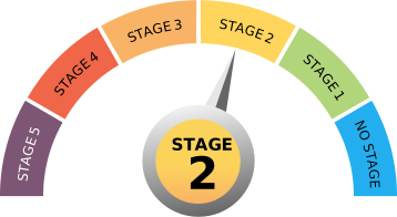
Stage 2 pointed to on a meter
30% CURRENT REDUCTION
Uvalde Pool
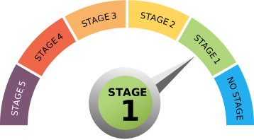
Stage 4 pointed to on a meter
35% CURRENT REDUCTION
Caution icon
Critical Period/Drought Management
San Antonio (J17WL) 646.1 10 DAY AVERAGE
651.9
TODAY
651.7
YESTERDAY
Uvalde (J27WL) 841.5 10 DAY AVERAGE
846.5
TODAY
846.1
YESTERDAY
Comal 177 10 DAY AVERAGE
191
TODAY
191
YESTERDAY
San Marcos 104 10 DAY AVERAGE
112
TODAY
113
YESTERDAY

10-Year Annual Recharge Average (2013-2022) 553,230 acre-feet

  • Understanding the reading
  • Display our readings on your website

Provisional Daily Water Readings as of 17:00:42 PM, July 20, 2026

logo

CURRENT AQUIFER CONDITIONS

TODAY'S READINGS
UVALDE
J-27

846.5
FT. AMSL

Index Well

UVALDE POOL

Bexar
J-17

651.9
FT. AMSL

Index Well
Comal
Springs

191
CFS

Springflow
San Marcos
Springs

112
CFS

Springflow

SAN ANTONIO POOL

10 DAY AVERAGE

J-27 Well
841.5 FT. AMSL

J-17 Well
646.1 FT. AMSL

Comal Springs
177 CFS

San Marcos Springs
104 CFS

FT AMSL = feet above mean sea level

CFS: cubic feet per second

Uvalde Pool is in Stage 4: 35% reduction
San Antonio Pool is in Stage 2: 30% reduction
Understanding the levels, springflows, stages and reductions
CURRENT & HISTORIC AQUIFER CONDITIONS

Last updated: July 20, 2026

This calculator is only available December 31st - January 31st. Please check back on December 31, 2025, to calculate your reductions for the year.

EAA Footer Slider-30th
Spotlight:: Take a walk through our history.

Celebrating 30 Years


Dive into our interactive timeline, browse historic photos, discover key milestones that shaped our journey,
and download exclusive wallpapers to celebrate with us.

Explore 30th Anniversary

Spotlight:: Photo Contest

Conserve and Share Photo Contest

We want to showcase how our community is staying Rooted in Texas.

This photo contest celebrates your creativity, conservation efforts, and connection to the EAA.

Your photos may inspire others—and could land you a spot in our 2027 calendar!

Learn More

EAA Footer Slider-Plant Giveaway_no background-plants
SPOTLIGHT:: NATIVE PLANT GIVEAWAY
Rooted in Texas

Free Drive-Thru Plant Pick-Up

Join the Edwards Aquifer Authority for a FREE native plant pick-up event.

Pick up native plants and learn how they help conserve water and protect the Edwards Aquifer.

Saturday, October 17 • 9:00 AM

Learn More →

EAA Footer Slider-TX Blind Salamander

Texas Blind Salamander

Did you know?

The Texas blind salamander is an indicator species. Since it depends on clean, stable groundwater to survive, it’s like a frontline reporter that lets us know how clean and safe our water is.

  • Twittertwitter X logo
  • InstagramInstagram logo
  • Facebookfavebook logo
  • Linkedinlinked in logo
  • Pinterestpinterest logo
  • Youtubeyoutube icon
Contact Us

900 E. Quincy
San Antonio, TX 78215

(210) 222-2204
1-800-292-1047

Subscribe to EAA News!

Subscribe
  • Groundwater Users
  • Aquifer Science
  • Aquifer Protection
  • Education
  • About
  • Online Portal
  • Online Payments
  • News
  • Calendar
  • Careers

© 2026 EDWARDS AQUIFER AUTHORITY Privacy Policy

Edwards Aquifer Conservancy logo EAHCP logo EOC logo
Online Payments

As part of a comprehensive effort to streamline processes for our permit holders and the regulated community, the EAA now offers an online payment program that allows individuals and business entities to pay for their transactions by credit card (American Express, Discover, MasterCard, or VISA) or by electronic check.

The payment site is operated and maintained by a secure, third party, payment processor. A convenience fee of 2.75% applies to all credit card transactions (a $2 minimum fee) and a $2.00 fee applies to e-check transactions. The EAA does not keep any portion of these convenience fees. After confirmation of payment, the EAA will coordinate internally to ensure your payment is posted to the correct account. This process may take up to 72 hours.


Proceed to Online Payments
2025-EAA-CPM-Uvalde-Pool-rev
2025-EAA-CPM-San-Antonio-Pool-06-10-25

Modal Box for Announcements As Needed

Modal Box for Announcements As Needed. Modal Box for Announcements As Needed

Learn More About This