
 Aquifer Conditions
Science & Data Document Library
Science and Data Resources
Leak Detection Survey Report for the city of Lytle
Description: Leak detection and location survey report for City of Lytle, 1992. Note: this function was taken over by the San Antonio Water System in 2006.
Report Number: 92-04
Location: Medina County, Atascosa County, Bexar County
Summary:On September 5, 1991, the City of Lytle submitted a request for the Edwards Underground Water District (EUWD) to perform a leak detection/location survey on its water distribution system. On November 25, 1991, a presurvey conference was held at the Lytle City Hall to discuss the work to be performed. It was agreed that EUWD would perform sonic leak detection on all available access points, computerized leak location as needed, record all system deficiencies found, and submit to the City an updated master water plat with the final report.
The survey began December 2, 1991, and was concluded on January 31, 1992. Over the course of the survey, EUWD surveyed a tot a 1 of 1,274 access points, including 973 customer service connections, 94 fire hydrants, 197 main valves, and 10 blow-off valves covering 29.40 miles of distribution main.
EUWD detected a total of 31 leaks. This total included 1 valve leak, 2 meter box leaks, 5 fire hydrant leaks, 6 service line leaks, 1 main line leak, and 16 customer side leaks. EUWD estimates 9,128 gallons per day has been saved by the repair of 10 detected leaks as of January 31, 1992. The leaks repaired to date range from 7,200 gallons per day to 3 gallons per day.
As part of the survey, EUWD located 144 buried main line valves with a ferromagnetic detector. EUWD noted 56 water meters that were not registering accurately and an additional 58 meter boxes that need cleaning.
Leak Detection/Location Survey Report for the City of Marion: May 1, 1996-May 31, 1996
Description: Leak detection and location survey report for City of Marion, TX, May 1-31, 1996. Note: this function was taken over by the San Antonio Water System in 2006.
Location: City of Marion, TX
Summary:On March 15, 1996, the Edwards Aquifer Authority (EAA), formerly the Edwards Underground Water District, received a request from the City of Marion to perform a leak detection I location survey on its water distribution system. A pre-survey conference was held April 4, 1996 at the City of Marion to discuss the work to be performed. It was agreed that EAA wou ld perform sonic leak detection on all available access points and computerized leak location as needed. A final report, including any unusual system condition found and an updated master water plat would be submitted to the City of Marion by EAA at the conclusion of the survey.
John E. Gapinski of EAA began the survey on May 1, 1996, and the survey was concluded on May 31, 1996. Over the course of the survey, a total of 817 access points were surveyed including 615 customer service connections, 34 fire hydrants, 158 valves, and 10 other access points covering 25.42 miles of distribution and transmission main.
Fourteen utility side leaks and eleven customer side leaks were detected for a total of 25 leaks. The utility side leaks included 4 service leaks, 7 meter box leaks, 1 fire hydrant leak, and 2 main leaks. An estimated 14,697 gallons of water per day has been saved by the repair of 14 utility side leaks as of June 15, 1996. The leaks discovered during the survey range from 3,960 gallons per day to small meter box leaks.
Leak Detection/Location Survey Report for the Fairco Water Company, Bexar County, Texas: December 13, 1995-March 8, 1996
Description: Leak detection and location survey report for Fairco Water Company, 1996. Note: this function was taken over by the San Antonio Water System in 2006.
Location: Bexar County
Summary:On November 20, 1995, the Edwards Aquifer Authority (EAA) received a request fromthe Fairco Water Company to perform a leak detection I location survey on its waterdistribution system. A pre-survey conference was held November 15, 1995, at the FaircoWater Company Office to discuss the work to be performed. It was agreed that EAA would perform sonic leak detection on all available access points and computerized leak location as needed. A final report, including any unusual system condition found and an updated master water plat would be submitted to the Company at the conclusion of the survey.
John E. Gapinski of EAA began the survey on December 13, 1995. The survey was concluded on March 8, 1996. Over the course of the survey, EAA surveyed a total of 3,320 access points including 1,697 customer service connections, 973 service valves, 82 fire hydrants, 529 main valves, and 39 other access points covering 47.58 miles of distribution main.
EAA surveyors detected 20 utility side leaks and 12 customer side leaks for a total of 32 leaks. The utility side leaks included 10 service leaks, 4 meter box leaks, 4 main leak, and 2 fire hydrant leaks. EAA estimates 98, 148 gallons of water per day has been saved by the repair of 20 utility side leaks as of April 18, 1996. The leaks discovered during the survey range from 71,280 gallons per day to small meter box leaks.
As part of the survey, EAA located 1,010 valves of various types, 4 fire hydrants, and 2,750 feet of main not shown on the master water plats. EAA surveyors were unable to locate 147 valves of various types and 1 fire hydrant shown on the master water plats. An additional 13 items were discovered to need cleaning, repair, or replacement.
Leak Detection Survey Report for the city of Schertz: Schertz, Texas, January 11, 1993 April 2, 1993
Description: Leak detection and location survey report for City of Schertz, 1993. Note: this function was taken over by the San Antonio Water System in 2006.
Report Number: 93-02
Location: Guadalupe County, Bexar County, Comal County
Summary:On December 23, 1991, the Edwards Underground Water District (EUWD) received a completed application form from the City of Schertz requesting a leak detection/location survey on its water distribution system. A pre-survey conference was held December 18, 1992 at the City of Schertz Water and Wastewater Service Center to discuss the work to be performed. It was agreed that EUWD would perform sonic leak detection on all available access points, computerized leak location as needed, record any unusual system conditions found, and submit to the utility an updated master water plat with the final report.
John E. Gapinski of EUWD began the survey on January 11, 1993, and the survey was concluded on April 2, 1993. Over the course of the survey, EUWD surveyed a total of 5,782 access points· including 4,163 customer service connections, 432 fire hydrants, 1,096 main line valves, and 91 other access points covering 99.99 miles of distribution mains. Computer leak sound correlation was performed on 7 locations.
EUWD technicians detected a total of 169 leaks. This total included 35 meter box leaks, 15 fire hydrant leaks, 8 valve leaks, 5 main leaks, 3 service leaks, and 103 customer side leaks. EUWD estimates 21,703 gallons of water per day has been saved by the repair of 46 detected leaks as of May 10, 1993. The leaks discovered during the survey range from 15,840 gallons per day to numerous small meter box leaks.
As part of the survey, EUWD located 452 main line valves, 171 fire hydrants, and 36.1 miles of distribution main not shown on the master water plats. EUWD staff were unable to locate 9 fire hydrants and 49 main line valves. An additional 39 valve stacks need cleaning and/or repair and 4 valve lids were discovered missing.
Leak Detection/Location Survey Report for Southwest Texas State University, Hays County, Texas, April 22, 1996-July 26, 1996
Description: Leak detection and location survey report for Southwest Texas State University, April 22, 1996-July 26, 1996. Note: this function was taken over by the San Antonio Water System in 2006.
Location: Southwest Texas State University, San Marcos, TX
Summary:On April 19, 1996, the Edwards Aquifer Authority (EAA) received a request from Southwest Texas State University (SWT) to perform a leak detection I location survey on its water distribution system. A pre-survey conference was held April 22, 1996, at the Southwest Texas Physical Plant to discuss the work to be performed. It was agreed that EAA would perform sonic leak detection on all available access points and computerized leak location as needed. A final report, including any unusual system condition found, and an updated master water plat would be submitted to the SWT at the conclusion of the survey.
James R. Shipley of EAA began the survey on April 22, 1996. The survey was concluded on July 26, 1996. Over the course of the survey, EAA surveyed a total of 468 access points including 102 service connections, 21 fire hydrants, 183 valves, and 162 other access points covering 10.17 miles of distribution main.
Mr. Shipley detected a total of 52 leaks. These leaks included 11 service leaks, 10 hose bib leaks, 11 main leaks, 10 valve leaks, 3 toilet leaks, 4 sprinkler system leaks, 2 miscellaneous leaks and 1 fire hydrant leak. EAA estimates 76,217 gallons of water per day has been lost from these leaks. The leaks discovered during the survey range from 25,920 gallons per day to small hose bib leaks.
As part of the survey, EAA located 78 valves of various types, 6 back flow preventors, 1 fire hydrant, and 7 meters not shown on the master water plats. EAA surveyors were unable to locate 13 valves of various types shown on the master water plats. An additional 6 items were discovered to need some type of repair or adjustment.
Leak Detection Survey Report for Southwest Texas State University, San Marcos: June 14, 1993-June 18, 1993
Description: Leak detection and location survey report for Southwest Texas State University, June 14-18, 1993. Note: this function was taken over by the San Antonio Water System in 2006.
Report Number: 93-04
Location: Southwest Texas State University, San Marcos, TX
Summary:On June 3, 1993, the Edwards Underground Water District (EUWD) received a completed application form from Southwest Texas State University requesting a leak detection/location survey on its water distribution system. A pre-survey conference was held June 11, 1993 at the University Physical Plant to discuss the work to be performed.
It was agreed that EUWD would perform sonic leak detection on all available access points, computerized leak location as needed, record any unusual system conditions found, and submit to the University a revised master water plat with the final report.
John E. Gapinski of EUWD began the survey on June 14, 1993, and the survey was concluded on June 18, 1993. over the course of the survey, EUWD surveyed a total of 185 access points including 147 valves, 17 fire hydrants, 9 service connections, and 12 other access points covering 8.05 miles of distribution mains. Computer leak sound correlation was performed on 4 locations.
EUWD technicians detected a total of 8 leaks. This total included 4 main line leaks, 2 fire hydrant leaks, 1 meter box leak, and 1 valve leak. EUWD estimates 298,080 gallons of water per day has been saved by the repair of 3 detected leaks as of June 18, 1993. The leaks discovered during the survey range from 126,720 gallons per day to a small meter box leak.
As part of the survey, EUWD noted 12 main valves and 1 fire hydrant that could not be located. Additionally, two valve stacks need repair and two are missing lids.
Leak Detection/Location Survey Report for the City of Garden Ridge, Comal County, Texas: March 1, 1996-April 30, 1996
Description: Leak detection and location survey report for City of Garden Ridge, March 1, 1996-April 30, 1996. Note: this function was taken over by the San Antonio Water System in 2006.
Location: City of Garden Ridge, Comal County, TX
Summary:On December 21, 1995, the Edwards Aquifer Authority (EAA) received a request from the City of Garden Ridge to perform a leak detection I location survey on its water distribution system. A pre-survey conference was held February 21, 1996, at the City of Garden Ridge City Hall to discuss the work to be performed. It was agreed that EAA would perform sonic leak detection on all available access points and computerized leak location as needed. A final report, including any unusual system condition found and an updated master water plat would be submitted to the City at the conclusion of the survey.
John E. Gapinski of EAA began the survey on March 1, 1996. The survey was concluded on April 30, 1996. Over the course of the survey, EAA surveyed a total of 914 access points including 696 customer service connections, 71 fire hydrants, 136 valves, and 11 other access points covering 19.09 miles of distribution main.
Mr. Gapinski detected 15 utility side leaks and 11 customer side leaks for a total of 26 leaks. The utility side leaks included 10 service leaks, 2 meter box leaks, 2 main leaks, and 1 fire hydrant leak. EAA estimates 69,016 gallons of water per day has been saved by the repair of 15 utility side leaks as of May 21, 1996. The leaks discovered during the survey range from 28,368 gallons per day to small meter box leaks.
As part of the survey, EAA located 47 valves of various types, 200 services, 11 fire hydrants, and 11, 150 feet of main not shown on the master water plats. EAA surveyors were unable to locate 20 valves of various types shown on the master water plats. An additional 2 items were discovered to need some type of repair or adjustment.
Leak Detection/Location Survey Report for East Medina County Water Supply Corporation, August 10, 1995-October 10, 1995
Description: Leak detection and location survey report for East Medina County Water Supply Corporation, August 10, 1995-October 10, 1995. Note: this function was taken over by the San Antonio Water System in 2006.
Report Number: 95-10
Location: East Medina County, TX
Summary:On February I 7, 1995, the Edwards Underground Water District (EUWD) received a request from the East Medina County Water Supply Corporation (EMCWSC) to perform a leak detection/ location survey on its water distribution system. A pre-survey conference was held at the EMCWSC office to discuss the work to be performed. It was agreed that EUWD would perform sonic leak detection on all available access points and computerized leak location as needed. A final report, including any unusual system condition found and an updated master water plat would be submitted to East Medina County Water Supply Corporation, by EUWD at the conclusion of the survey.
Mark L McGinnis of EUWD began the survey on August 10, 1995 , and the survey was terminated on October I 0, 1995. Over the course of the survey, a total of 287 access points were surveyed including 219 customer service connections, 240 valves, and 34 other access points covering 12.74 miles of distribution main.
Ten utility side leaks and 28 customer side leaks were detected for a total of 38 leaks. The utility side leaks included 2 meter box leaks, 7 main leaks, and I service leak. An estimated 1,730 gallons of water per day has been saved by the repair of the 10 utility side leaks. The leaks discovered during the survey range from 720 gallons per day to small meter box leaks.
As part of the survey, 6 services and 17 valves of various types were located that were not shown on the master water plats. EUWD surveyors were unable to survey 13 valves and 3 services shown on the master water plats.
Leak Detection/Location Survey Report for the City of Kyle, May 16, 1995-June 5, 1995
Description: Leak detection and location survey report for City of Kyle, TX from May 16, 1995-June 5, 1995. Note: this function was taken over by the San Antonio Water System in 2006.
Report Number: 95-08
Location: City of Kyle, TX
Summary:On May 9, 1995, the Edwards Underground Water District (EUWD) received a request from the City of Kyle to perform a leak detection/location survey on its water distribution system. A pre-survey conference was held May 12, 1995, at the City of Kyle to discuss the work to be performed. It was agreed that EUWD would perform sonic leak detection on all available access points and computerized leak location as needed. A final report, including any unusual system condition found and an updated master water plat would be submitted to the City of Kyle by EUWD at the conclusion of the survey.
John E. Gapinski of EUWD began the survey on May 16, 1995, and the survey was concluded on June 5, 1995. Over the course of the survey, a total of 1,464 access points were surveyed including 1,023 customer service connections, 106 fire hydrants, 328 valves, and 7 other access points covering 29.70 miles of distribution main.
Thirteen utility side leaks and 3 customer side leaks were detected for a total of 16 leaks. The utility side leaks included 2 service leaks, 8 meter box leaks, and 3 main leaks. An estimated 260,734 gallons of water per day has been saved by the repair of the 13 utility side leaks.
The leaks discovered during the survey range from 254,592 gallons per day to small meter box leaks.
The Abbreviated Water Conservation Working Handbook
Description: An abbreviated version of the more comprehensive Water Conservation Working Handbook. Used by Water Conservation Task Force Committees throughout the Edwards Underground Water District, the complete Working Handbook promotes the development and use of new technologies and practices that improve water use efficiency. Note: This document is included for historical value but may have been superseded by more recent reports.
Location: Edwards Aquifer Balcones Fault Zone San Antonio Segment
Summary:An abbreviated version of the more comprehensive Water Conservation Working Handbook. Used by Water Conservation Task Force Committees throughout the Edwards Underground Water District, the complete Working Handbook promotes the development and use of new technologies and practices that improve water use efficiency. Note: This document is included for historical value but may have been superseded by more recent reports.
The Water Level
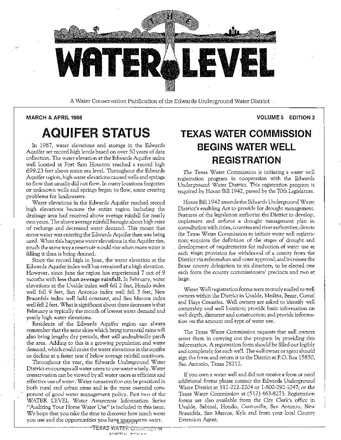
Description: Periodical publication of the Edwards Underground Water District for the general public
Report Number: Vol 5 (#2-6) 1988 Vol 6 (#1-1) 1989
Location: General
Summary:Periodical publication of the Edwards Underground Water District for the general public
Leak Detection/Location Survey Report for County Line Water Supply Corporation Caldwell & Hays Counties, Texas
The Water Level
Evaluation of the Edwards Aquifer in Kinney and Uvalde Counties, Texas
Description: Development of an updated conceptual model in the Edwards Aquifer for the Kinney County and Uvalde Pools and the relationship of the latter to the San Antonio Pool
Location: Edwards Aquifer, Balcones Fault Zone, San Antonio Segment, Kinney County, Uvalde County,
Summary:Notes:
There is a problem reading pp 3-5 of the pdf file.
Data from Attachment A are available from the Authority upon request.
The purpose of this study was to (1) develop an updated conceptual model of the groundwater systems in Uvalde County that incorporates existing and recently collected data on hydrology, geochemistry, and structural geology, and (2) clearly define the hydrogeologic relationship between the Uvalde pool and the San Antonio pool of the Edwards Aquifer. The area of investigation consisted of Kinney and Uvalde counties and included the groundwater divide in Kinney County to the west and the Knippa Gap to the east. It includes all the of the principal aquifers in Uvalde and Kinney counties. The study was completed in June 2006 by Southwest Research Institute, San Antonio, Texas. Note: Attachment A data are available from the Authority upon request
[From the Executive Summary]
The objective of this investigation was to evaluate the groundwater systems in Uvalde County and develop an updated conceptual model that (i) incorporates existing and newly collected data on hydrology, geochemistry, and structural geology, and (ii) clearly defines the hydraulic and hydrogeologic relationship between the Uvalde pool and the San Antonio pool of the Edwards Aquifer. It is imperative to have an accurate, comprehensive understanding of this relationship to be able to effectively manage the water resources of the Edwards Aquifer in Uvalde County and, more generally, all water sources associated with the Edwards Aquifer in and beyond Uvalde County. The boundaries of the study area coincide with those of Kinney and Uvalde counties.
Refined or new conceptual models of the groundwater systems were developed for Kinney and Uvalde counties. Assessment of the stratigraphic and facies geology, structural geology, water chemistry, and hydrogeology provided the basis for the designation of a separate pool in the Edwards Aquifer in Kinney County which extends from a groundwater divide between Mud and Pinto creeks on the west to a zone of low permeability near the Kinney County/Uvalde County line on the east. All evidence suggests that recharge from the West Nueces River basin recharges the Kinney County pool, not the Uvalde pool of the Edwards Aquifer. This new conceptual model does not assert that there is no groundwater flow from the Kinney County pool to the Uvalde pool, only that there is limited or minimal flow.
Evaluations indicate that an average of 70,000 acre-ft annually recharges the Kinney County pool. Of this, approximately 6,000 acre-ft are annually removed by pumping and 20,000 acre-ft are discharged from Las Moras, Pinto, and Mud springs. This hypothesized conceptual model for the Kinney County pool contends that there is sufficient opportunity for discharge of the remaining 44,000 acre-ft, primarily through floodplains, nearby hydrostratigraphic units, and channels associated with rivers and creeks to the south of the Edwards Aquifer recharge zone.
The structure of the Knippa Gap was evaluated to help understand groundwater flow in Uvalde County. Geologic structural maps of the Edwards Aquifer provided an improved understanding of the principal components of groundwater flow through the Knippa Gap. Of greatest interest in this interpretation is the structure of the base of the Edwards Aquifer to the east of the City of Uvalde. There is a prominent ridge in the base of the Edwards Aquifer called the Uvalde Salient that reduces the saturated thickness of the Edwards Aquifer from 600 ft, to the east and west of the Uvalde Salient, to as little as 400 ft at the Uvalde Salient. The resulting topography of the base of the Edwards Aquifer is a series of prominent highpoints in the ridge that constrict groundwater flow through topographic saddles between the high points. This constriction results in a 4-mile wide high-capacity flow channel through central Uvalde County located immediately north of the City of Knippa. Cooks Fault forms its northern boundary and the structure of the Knippa Gap effectively forms its southern boundary. The chemistry of water in the channel is different from water south of the channel. Groundwater elevations suggest a groundwater trough coincident with the channel, which is an indication of high-transmissivity flow. Groundwater flow in the channel is essentially doubled by the addition of recharge from the Frio River-Dry Frio River basin at the Knippa Gap. The combined effect of the structural constriction and focused recharge at the Knippa Gap cause a damming of groundwater upgradient and to the west of the Knippa Gap.
Recharge and discharge volumes of most of the Edwards Aquifer in Uvalde County are highly uncertain, although progress was made during this investigation to limit this uncertainty. Recharge from the West Nueces River is believed to recharge the Kinney County pool, not the Uvalde pool. Discharge from the Edwards Aquifer through floodplains, nearby hydrostratigraphic units, and channels associated with the Nueces, Leona, and Frio rivers is hypothesized by this investigation to significantly exceed previous estimates. These conceptual changes call for rethinking of the existing water balance calculation for Uvalde County which is based on the long-term average of 226,300 acre-ft/yr of recharge from the Nueces River-West Nueces River and the Frio River-Dry Frio River basins. Using reasonable assumptions and characterizations, it is calculated that approximately 270,000 acre-ft/yr flows through the high-capacity flow channel from the Uvalde pool to the San Antonio pool of the Edwards Aquifer.
Although the assumptions inherent in this calculation make this estimate uncertain, it appears likely that total recharge in Uvalde County at least meets, if not exceeds, previous estimates. If the hypotheses provided in this report are valid, then recharge from the Nueces River and the Frio River-Dry Frio River basins, distributed recharge, and inflow from the Trinity and Austin Chalk aquifers, needs to be evaluated to improve estimates of the water balance of the Uvalde pool.
Soil Gas Survey and Soil Sample Analyses of Former Gensco, Inc Site and Properties Adjacent to Taylor Slough Uvalde, Texas / Edwards Underground Water District Field Investigation July 1988 through October 1988
Description: Report on field study of volatile organic compound (VOC) contaminants in soil at the former Gensco, Inc site in Uvalde, TX
Location: Uvalde
Summary:A series of soil gas surveys and a soil sampling event was conducted on properties adjacent to Taylor Slough in Uvalde, Texas from July through October 1988. The focus of these investigative efforts was the site of the former Gensco, Inc. pipe finishing facility. The purpose of the investigation was to assess potential source(s) of volatile organic compound (VOC) contamination to the Edwards and Leona aquifers.
Results of the survey indicate the presence of VOC in soil gas beneath the study area. The·highest VOC concentrations were detected beneath the site of the former Texas Industrial Services property west of the Taylor Slough. Tetrachloroethylene (PCE) is the predominant contaminant of these shallow soil gases.
An area of relatively high PCE concentrations in soil gas was found within the former Gensco Inc. site. These concentrations were three orders of magnitude less than those found under the former Texas Industrial Services site. Cores obtained from this area were tested by field head space and laboratory analyses. Head space analyses confirmed the presence of PCE. Laboratory analyses revealed the presence of only acetone and xylenes.


