
 Aquifer Conditions
Science & Data Document Library
Science and Data Resources
Comprehensive Water Management Plan Edwards Aquifer Authority
Description: Edward Aquifer Authoritys Comprehensive Water Management Plan as required by Section 1.25 of the Edwards Aquifer Authority Act, for 2000-2030.
Location: Edwards Aquifer Authority Jurisdiction
Summary:OVERVIEW OF PLAN DEVELOPMENT
The Edwards Aquifer Authority Act (Act) was passed in 1993 and legislators envisioned that the Authority would be the regional water planning entity responsible for developing a future water supply plan for the Edwards Aquifer Region. Section 1.25 of the Act requires the Authority to develop a CWMP complete with a 20-year water supply plan. However, in 1997, the Texas Legislature passed the Brown-Lewis Water Plan that led to the creation of 16 regional water planning groups by the Texas Water Development Board (TWDB) which became responsible for developing regional water supply plans.
Discussions with the CWMP Work Group, the Aquifer Management Planning Committee of the board, and the CWMP Stakeholder Group revealed that a duplicative planning effort for a major component of the CWMP, the 20-year water supply plan, was being conducted by the South Central Texas Regional Water Planning Group (SCTRWPG).
In order to avoid duplication, the Authority agreed to delay development of the CWMP pending the development of the SCTRWPG regional water supply plan. Additionally, to facilitate regional cooperation, the Authority modified the water supply component of the CWMP to 30-years from the original 20-years stipulated in the Act.
Legal challenges to the Authority's rules and subsequent changes further delayed the development of the CWMP. In 2001, the development of the Authority's five-year Strategic Plan took priority and completion of the CWMP was deferred pending its adoption in April 2002.
OVERVIEW OF THE PLAN
The key objective of the CWMP is to satisfy the Authority's statutory requirement to develop and adopt a regional water management plan. The CWMP is intended to serve as an umbrella document that encompasses all of the Authority's plans, programs, and policies essential to managing the Edwards Aquifer. The CWMP defines and outlines a coordinated operational plan that unifies all of the Authority's water management plans, programs, and policies into a cohesive aquifer management program that balances the needs and interests of all aquifer users.
In addition to federally endangered and threatened species concerns, another challenge that the plan addresses is the increasing water demand from a rapidly growing population. Coupled with these issues, the plan also addresses the mandate for the Authority to restrict permitted pumpage from the Edwards Aquifer to 450,000 acre-feet per year through December 2007. In addition, the Authority is required to reduce permitted pumpage to 400,000 acre-feet per year beginning in January 2008.
The planning area is projected to have an overall increase of approximately 34 percent in water demand from 2000 to 2030. Bexar County alone has projected an increase of more than one-half million people during this 30-year planning period, attributed primarily to the growth of San Antonio and surrounding suburban areas. Managing the aquifer as the major component of meeting the water supply needs of this relatively large influx of people into the planning area will be one of the greatest challenges faced by the Authority in the coming years.
Section 7.0 of this plan describes the various water management plans and programs developed by the Authority. The current water management strategies include:
*Water Quality Protection Program
*Groundwater Conservation and Reuse Plan
*Demand Management/Critical Period Management Plan
*Permit Program
*Alternative Water Supply Plan
*Habitat Conservation Plan
*Groundwater Management Plan
*Applied Research
*Withdrawal Reduction and Permit Retirement Plans
*Recharge Storage and Recovery Program
Research supports the Authority's planning process. Section 9.0 describes the ongoing planning processes that include:
*Edwards Aquifer Optimization Program
*Alternative Technology
*Data Acquisition and Analysis
The CWMP will be evaluated annually and a report presented to the Authority's Board of Directors (board). Revisions and modifications will be determined by the development of new data regarding management of the aquifer, legislative changes that affect the Authority, and policy directions of the board.
Edwards Aquifer Authority Groundwater Management Plan 1998-2008
Description: Groundwater management plan for the Edwards Aquifer Authority for 1998-2008 Note: This report is included for its historical value but has been replaced by a more recent study.
Location: Edwards Aquifer Authority Jurisdiction
Summary:The Edwards Aquifer Authority has prepared this Groundwater Management Plan to fulfill the requirements of the Brown-Lewis Water Plan and associated TWDB rules (Texas Administrative Code, Chapter 356). In addition, this plan is the first step towards fulfilling the requirements of the Edwards Aquifer Authority's enabling statute (73rd Texas Legislature, S.B. 1477 as amended, herein referred to as the EAA Act), which also requires the Edwards Aquifer Authority to develop and implement a comprehensive management plan.
As required by TWDB rules, the Edwards Aquifer Authority's groundwater management plan was developed with a 10-year planning period. However, it is likely this plan will be revisited and substantially revised much sooner to incorporate new information, as well as new policy and program mJUauves. Specifically, it is expected that the Edwards Aquifer Authority's groundwater management plan will be amended to include relevant portions of, and ensure consistency with, the regional water management plan also mandated by the Brown-Lewis Water Plan.
Table of Contents
1.0 Introduction
2.0 About the Edwards Aquifer Authority
3.0 Description of the Planning Area
4.0 Goals, Management Objectives and Performance Standards
5.0 Meeting Future Water Supply Needs
6.0 On Going Planning Functions of the Edwards Aquifer Authority
Edwards Underground Water District
Description: General description of the Edwards Aquifer, and the mission and functions of the Edwards Underground Water District. Note: this document has been included for historical value.
Location: Edwards Underground Water District Jurisdiction
Summary:General description of the Edwards Aquifer, and the mission and functions of the Edwards Underground Water District. Note: this document has been included for historical value.
San Antonio and Bexar County, Texas Report on Reclamation and Re-Use of Municipal Wastewater
Description: Feasibility study on possible uses of reclaimed wastewater in Bexar and Medina Counties and impact on withdrawal from and recharge to the Edwards Aquifer Note: This report is included for its historical value and may have been superseded by more recent studies.
Location: San Antonio, Bexar County, Medina County
Summary:Note: This report is included for its historical value and may have been superseded by more recent studies.
This study was authorized in April of 1969 by the City of San Antonio, the San Antonio City Public Service Board, the San Antonio City Water Board, the Bexar Metropolitan Water District, the San Antonio River Authority, and the Edwards Underground Water District. It gives consideration to the following principal objectives:
a. Use where practical of treated wastewater for applications which will tend to minimize future withdrawals from the Edwards Underground Reservoir.
b. Effective development of the Medina River watershed for recharge of the Edwards Underground Reservoir and as a supplemental source of surface water supply for San Antonio.
c. Reclamation of Mitchell Lake for esthetic, recreational and other potential uses.
d. Possible gains in recreational use at Lakes Braunig and Calaveras because of improved water quality and at Lake Medina from maintenance of higher water levels.
Included herein are estimates of future wastewater volumes and of the requirements which might be met through use of reclaimed wastewater in lieu of ground water pumpage. The hydrology of the Medina River Basin is outlined in some detail to show the influence of Lake Medina on recharge of the Edwards Underground Reservoir and the amount of surface water which can be obtained at the Applewhite Reservoir site .
Attention is given to the character of wastewater treatment which would be required to produce water of suitable quality for the contemplated applications. Finally, economic analyses are presented relative to costs, benefits, and possible methods of financing.
As results of the investigation were reviewed with representatives of the sponsoring organizations, it was found desirable to add further items to the scope of the work. In July of 1970, it was agreed that the study would include discussion of a gravity-flow interconnection between Lakes Mitchell, Braunig and Calaveras. In October 1970, it was decided to give consideration to possible irrigation along the south side of the San Antonio River in southeastern Bexar County and northwestern Wilson County. The first of these items was included because of its potential relevance to power plant operation at the lakes and to over-all quality of waters in the lakes and the San Antonio River. Irrigation to the southeast of San Antonio, although it would not reduce withdrawals from the Edwards Underground Reservoir, is an apparent alternative use for the reclaimed wastewater and was added so that it might be compared with the various applications which would affect the availability of water from the Edwards limestone.
CONCLUSIONS AND RECOMMENDATIONS
a. San Antonio's wastewater reclamation plants are currently producing approximately 100,000 acre-feet per year of water that can be re-used for some purposes, and the amount is expected to increase to 173,000 acre-feet per year by the end of the century.
b. The two most promising uses for reclaimed wastewater in the San Antonio area are irrigation and pow1er plant cooling. At the present time, 16,200 acre-feet per year have been committed to existing obligations for irrigation in the vicinity of Mitchell Lake, and 72,000 acre-feet per year are covered by permits for diversions to Lake Braunig and Lake Calaveras.
c. Once the Braunig and Calaveras Power plants are developed to full capacity, water requirements to replace evaporative losses and maintain suitable chemical concentrations in the cooling lakes will be more than the present diversion permits. The estimated peak requirements are 24,000 acre-feet per year at Lake Braunig and 69,800 acre-feet per year at Lake Calaveras. Their existing permits are for 12,000 acre-feet per year and 60,000 acre-feet per year, respectively.
d. In general, power plant cooling use offers greater over-all benefits than irrigation, especially in terms of ground water conservation and recreation. Where it is necessary to choose between the two, first preference should be given to the power plant needs.
e. The total of existing obligations and other potential uses will exceed the available supply of reclaimed wastewater for the next 20 years or longer. There probably will not be sufficient uncommitted wastewater for new 1arge-scale irritigation until 1990 or after. The proposed irrigation operations west of San Antonio, which would require from 25,000 to 40,000 acre-feet per year, are thus long-term considerations rather than prospects for the near future. A lesser volume (9,200 acre-feet per year) of new irrigation southeast of San Antonio could be supplied now if backed by a moderate amount of regulating storage.
f. Eventual use of reclaimed wastewater to meet the irrigation requirements of Bexar-Medina-Atascosa Counties Water Improvement District No. 1 in lieu of the supply from Lake Medina would gain an average of 15,700 acre-feet per year in increased recharge and yield from the Medina River. The amount of reclaimed water needed would be in the range of 25,000 to 35,000 acre-feet per year, plus an estimated 20% additional to replace losses in the conveyance system. The corresponding unit expenditure per 1,000 gallons of increased recharge and yield would range from 21.5¢ to 26.0¢ at present-day cost levels. Operation of Lake Medina for recharge instead of irrigation would result in higher water levels in that reservoir part of the time; however, the recreational improvement would not be sufficient to offset the inherently high costs of delivering the reclaimed water to the Medina canal. Use of reclaimed wastewater for irrigation in the Bexar-Medina-Atascosa District does not appear to be economically justified.
g. Use of reclaimed wastewater for irrigation of other lands along the Medina River in western Bexar and eastern Medina Counties would reduce the long-range ground water pumpage in that area by as much as 40,000 acre-feet per year for an estimated unit cost of 11.2¢ per 1,000 gallons of ground water conserved at today's cost levels. Use of the reclaimed water for large-scale irrigation of such lands would be economically justified on that basis.
h. Approximately 4,000 acres of land along the south bank of the San Antonio River in southeastern Bexar County and northwestern Wilson County could be supplied with reclaimed wastewater for irrigation. The supply would be dependable only if supported by some 3,300 to 3,700 acre-feet of regulating storage not already committed to other purposes. Mitchell Lake could serve this need if not otherwise utilized. The estimated cost of delivering the reclaimed water to this area is $32.50 per year per acre.
i. Sites for additional power plant cooling lakes near San Antonio are limited, and the only likely prospect appears to be at Mitchell Lake. It is feasible to raise Mitchell Lake 12 feet, which would provide enough surface area to support a generating plant of about 1,400 megawatts capacity. The estimated capital cost to raise the water surface 12 feet is $1.58 million. If Mitchell Lake is to be considered seriously as a power plant site, it must be available in the immediate future. After about 1978, a lake of that size may well be too small to accommodate the large generating units projected to be needed by that time.
j. Use of Mitchell Lake for something other than its present purpose would require construction of new facilities for disposal of waste activated sludge and primary digester supernatant at the Rilling Road plants. The estimated capital cost of providing such facilities is $3.5 million. The added unit cost of sewage treatment at the Rilling Road plants due to adoption of a new system for waste activated sludge and digester supernatant could be expected to be between $15 and $20 per million gallons treated, including debt service on the capital investment.
Trans-Texas Water Program West Central Study Area Phase 2 Edwards Aquifer Recharge Analyses
Description: Part of Phase II of the West Central Study Area, Trans-Texas Water Program. Included for historical value; has been replaced by more recent plans.
Location: Guadalupe-San Antonio River Basin, Edwards Aquifer
Summary:Part of Phase II of the West Central Study Area, Trans-Texas Water Program. Included for historical value; has been replaced by more recent plans.
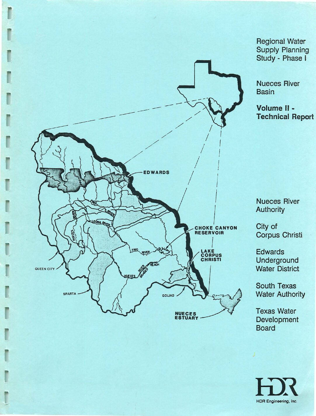
Regional Water Supply Planning Study Phase I Nueces River Basin Volume II Technical Report
Description: Note: This report is included for its historical value and may have been replaced by more recent studies. Technical study for 1991 water supply plan for the Nueces River Basin emphasizing construction of recharge structures (dams and reservoirs)
Location: Nueces River Basin
Summary:Note: This report is included because of its possible historical value. It has been replaced by more recent plans.
[From the Executive Summary]
The study area consists primarily of the Nueces River Basin, which covers an area of approximately 17,000 square miles in South Texas as shown in Figure ES-1. Several entities interested in the potential development of additional water supplies in the basin, along with the Texas Water Development Board (TWDB), have jointly participated in the performance of this study. These four entities are: Nueces River Authority (Authority); City of Corpus Christi; Edwards Underground Water District (EUWD); and South Texas Water Authority (STW A).
Over the past several decades, increasing water demands on the Edwards Aquifer have raised concerns about the ability of the aquifer to meet these demands without causing social, economic, and environmental problems. The headwaters of the Nueces River Basin contribute about 57 percent of the total volume of surface water recharge to the San Antonio portion of the Edwards Aquifer. Streams crossing the Edwards Aquifer recharge zone lose a significant portion of their flow through faults and solution cavities in the limestone formations. A large portion of the runoff from the headwater area, however, occurs during storms which exceed the capacity of the recharge zone. It has been suggested that, if recharge enhancement structures were constructed, aquifer water levels, well yields, and springflows would benefit.
The concept of building recharge structures is not new. In 1964, the U.S. Army Corps of Engineers (COE) identified numerous potential sites for recharge projects.[See Volumes 1-3 of Survey Report on Edwards Underground Reservoir Guadalupe, San Antonio and Nueces Rivers and Tributaries, Texas.) Since 1974, the Edwards Underground Water District has undertaken the construction of three small recharge projects in the basin. The locations of the EUWD recharge projects as well as the locations of those projects identified by the COE (and others) are shown in Figure ES-1.
Approximately 98 percent of the drainage area of the Nueces River basin is located upstream of the Choke Canyon Reservoir/Lake Corpus Christi System (CC/LCC System). The locations of these two reservoirs are shown in Figure ES-1. The CC/LCC System is operated by the City of Corpus Christi, with the majority of water being diverted from the system at the Calallen Diversion Dam located 35 miles downstream of Lake Corpus Christi.
At this location, the water is diverted from the river and distributed to various municipal and industrial users. The CC/LCC System is the primary source of municipal and industrial water supply for a significant portion of the Texas Coastal Bend. Reductions in the inflows to these two reservoirs that could result from the construction of additional recharge projects is an important consideration in the evaluation of any recharge program.
Ongoing studies of the Nueces Estuary, which include Nueces, Corpus Christi, Oso, and Redfish Bays and a portion of the Laguna Madre, by the Texas Water Development Board (and others) have shown that freshwater inflows play an important role in the productivity and viability of the estuary. Reduction of inflow to the Nueces Estuary that could result from the construction of additional recharge structures is also an important consideration.
The primary objectives of this study are listed below and were accomplished through the development and application of a computer model of the Nueces River Basin.
*Determine the potential for increasing artificial recharge to the Edwards Aquifer through construction of additional recharge structures in the Nueces River Basin;
*Calculate the firm yield of the Choke Canyon Reservoir /Lake Corpus Christi System with and without additional recharge structures; and
*Quantify the potential impacts of additional recharge structures on inflows to the Nueces Estuary.
Additional objectives of the study included:
*Independent evaluation of U.S. Geological Survey (USGS) estimates of historical natural recharge to the Edwards Aquifer from the Nueces River Basin;
*Estimation of future water demands for the Nueces River Basin through the year 2040 with emphasis on estimating future demands of the CC/LCC service area;
*Evaluation of the firm yield of the CC/LCC System with respect to its ability to meet future demands through the year 2040; and
*Development of recommendations for additional study.
Significant study findings and conclusions are as follows:
*Historical recharge to the Nueces River Basin portion of the Edwards Aquifer can be increased by an average of about 85,300 ac-ft per year if all seven Type 1 recharge structures are constructed and all water rights are honored. This represents an increase of about 26.3 percent in the historical average recharge to the Nueces River Basin portion of the Edwards Aquifer from surface water sources. Recharge during the 10-year drought period from 1947 through 1956 could be increased by about 19,100 ac-ft per year or 12.3 percent of the historical average during this 10-year period.
*Recharge with all twelve Type 2 recharge structures in place can be increased.on the average .by about 61,100 ac-ft per year or 18.9 percent if ·all water rights are honored. For the 1947-1956 drought period, recharge could be increased by about 24,100 ac-ft per year or 15.5 percent
*The recharge estimates in this report represent a theoretical maximum and are subject to significant reductions due to likely economic, environmental, structural, and political limitations on more detailed review.
*With no additional recharge structures in place, the firm yield of the CC/LCC System under Phase IV operating policy is 220,000 ac-ft per year for 1990 conditions and 197,500 ac-ft per year for 2040 conditions. These yields are based on existing water rights diverting at full authorization and do not consider the full release of 151,000 ac-ft per year to the Nueces Estuary. If system releases needed to insure 151,000 ac-ft of annual estuarine inflows are made, without abeyance provisions for drought conditions, then the 1990 firm yield is 166,300 ac-ft per year and the 2040 firm yield is 147,300 ac-ft per year.
*With no additional recharge structures in place, the firm yield of the CC/LCC System under Phase II operating policy is 187,800 ac-ft per year for 1990 conditions and 169,700 ac-ft per year for 2040 conditions. These ·yields are based on existing water rights diverting at full authorization and do not consider the full release of 151,000 ac-ft per year to the Nueces Estuary. If system releases needed to insure 151,000 ac-ft of annual estuarine inflows are made, without abeyance provisions for drought conditions, then the 1990 firm yield is 122,400 ac-ft per year and the 2040 firm yield is 107,100 ac-ft per year.
*The 1990 firm yield of the CC/LCC System would be reduced by up to 3,900 ac-ft ·per year with the implementation of all seven Type 1 recharge structures, if these structures were operated not to honor the water rights of the CC/LCC System.
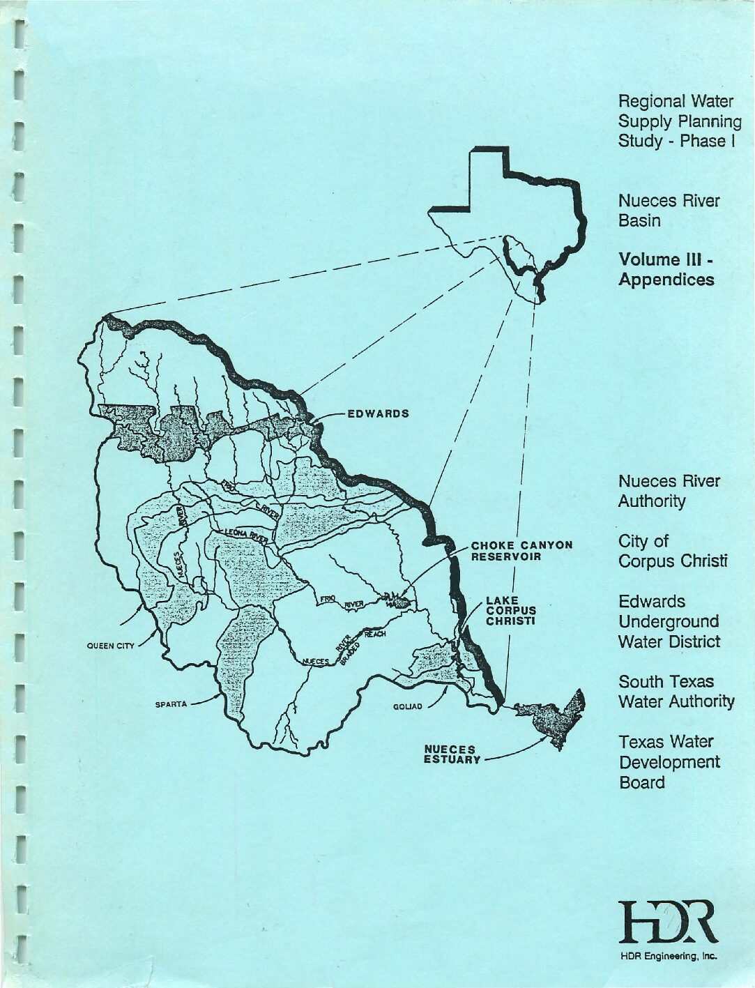
Regional Water Supply Planning Study Phase I Nueces River Basin Volume III Appendices
Description: Note: This report is included for its historical value and may have been replaced by more recent studies. Appendices for 1991 water supply plan for the Nueces River Basin emphasizing construction of recharge structures (dams and reservoirs)
Location: Nueces River Basin
Summary:Note: This report is included because of its possible historical value. It has been replaced by more recent plans.
[From the Executive Summary]
The study area consists primarily of the Nueces River Basin, which covers an area of approximately 17,000 square miles in South Texas as shown in Figure ES-1. Several entities interested in the potential development of additional water supplies in the basin, along with the Texas Water Development Board (TWDB), have jointly participated in the performance of this study. These four entities are: Nueces River Authority (Authority); City of Corpus Christi; Edwards Underground Water District (EUWD); and South Texas Water Authority (STW A).
Over the past several decades, increasing water demands on the Edwards Aquifer have raised concerns about the ability of the aquifer to meet these demands without causing social, economic, and environmental problems. The headwaters of the Nueces River Basin contribute about 57 percent of the total volume of surface water recharge to the San Antonio portion of the Edwards Aquifer. Streams crossing the Edwards Aquifer recharge zone lose a significant portion of their flow through faults and solution cavities in the limestone formations. A large portion of the runoff from the headwater area, however, occurs during storms which exceed the capacity of the recharge zone. It has been suggested that, if recharge enhancement structures were constructed, aquifer water levels, well yields, and springflows would benefit.
The concept of building recharge structures is not new. In 1964, the U.S. Army Corps of Engineers (COE) identified numerous potential sites for recharge projects.[See Volumes 1-3 of Survey Report on Edwards Underground Reservoir Guadalupe, San Antonio and Nueces Rivers and Tributaries, Texas.) Since 1974, the Edwards Underground Water District has undertaken the construction of three small recharge projects in the basin. The locations of the EUWD recharge projects as well as the locations of those projects identified by the COE (and others) are shown in Figure ES-1.
Approximately 98 percent of the drainage area of the Nueces River basin is located upstream of the Choke Canyon Reservoir/Lake Corpus Christi System (CC/LCC System). The locations of these two reservoirs are shown in Figure ES-1. The CC/LCC System is operated by the City of Corpus Christi, with the majority of water being diverted from the system at the Calallen Diversion Dam located 35 miles downstream of Lake Corpus Christi.
At this location, the water is diverted from the river and distributed to various municipal and industrial users. The CC/LCC System is the primary source of municipal and industrial water supply for a significant portion of the Texas Coastal Bend. Reductions in the inflows to these two reservoirs that could result from the construction of additional recharge projects is an important consideration in the evaluation of any recharge program.
Ongoing studies of the Nueces Estuary, which include Nueces, Corpus Christi, Oso, and Redfish Bays and a portion of the Laguna Madre, by the Texas Water Development Board (and others) have shown that freshwater inflows play an important role in the productivity and viability of the estuary. Reduction of inflow to the Nueces Estuary that could result from the construction of additional recharge structures is also an important consideration.
The primary objectives of this study are listed below and were accomplished through the development and application of a computer model of the Nueces River Basin.
*Determine the potential for increasing artificial recharge to the Edwards Aquifer through construction of additional recharge structures in the Nueces River Basin;
*Calculate the firm yield of the Choke Canyon Reservoir /Lake Corpus Christi System with and without additional recharge structures; and
*Quantify the potential impacts of additional recharge structures on inflows to the Nueces Estuary.
Additional objectives of the study included:
*Independent evaluation of U.S. Geological Survey (USGS) estimates of historical natural recharge to the Edwards Aquifer from the Nueces River Basin;
*Estimation of future water demands for the Nueces River Basin through the year 2040 with emphasis on estimating future demands of the CC/LCC service area;
*Evaluation of the firm yield of the CC/LCC System with respect to its ability to meet future demands through the year 2040; and
*Development of recommendations for additional study.
Significant study findings and conclusions are as follows:
*Historical recharge to the Nueces River Basin portion of the Edwards Aquifer can be increased by an average of about 85,300 ac-ft per year if all seven Type 1 recharge structures are constructed and all water rights are honored. This represents an increase of about 26.3 percent in the historical average recharge to the Nueces River Basin portion of the Edwards Aquifer from surface water sources. Recharge during the 10-year drought period from 1947 through 1956 could be increased by about 19,100 ac-ft per year or 12.3 percent of the historical average during this 10-year period.
*Recharge with all twelve Type 2 recharge structures in place can be increased.on the average .by about 61,100 ac-ft per year or 18.9 percent if ·all water rights are honored. For the 1947-1956 drought period, recharge could be increased by about 24,100 ac-ft per year or 15.5 percent
*The recharge estimates in this report represent a theoretical maximum and are subject to significant reductions due to likely economic, environmental, structural, and political limitations on more detailed review.
*With no additional recharge structures in place, the firm yield of the CC/LCC System under Phase IV operating policy is 220,000 ac-ft per year for 1990 conditions and 197,500 ac-ft per year for 2040 conditions. These yields are based on existing water rights diverting at full authorization and do not consider the full release of 151,000 ac-ft per year to the Nueces Estuary. If system releases needed to insure 151,000 ac-ft of annual estuarine inflows are made, without abeyance provisions for drought conditions, then the 1990 firm yield is 166,300 ac-ft per year and the 2040 firm yield is 147,300 ac-ft per year.
*With no additional recharge structures in place, the firm yield of the CC/LCC System under Phase II operating policy is 187,800 ac-ft per year for 1990 conditions and 169,700 ac-ft per year for 2040 conditions. These ·yields are based on existing water rights diverting at full authorization and do not consider the full release of 151,000 ac-ft per year to the Nueces Estuary. If system releases needed to insure 151,000 ac-ft of annual estuarine inflows are made, without abeyance provisions for drought conditions, then the 1990 firm yield is 122,400 ac-ft per year and the 2040 firm yield is 107,100 ac-ft per year.
*The 1990 firm yield of the CC/LCC System would be reduced by up to 3,900 ac-ft ·per year with the implementation of all seven Type 1 recharge structures, if these structures were operated not to honor the water rights of the CC/LCC System.
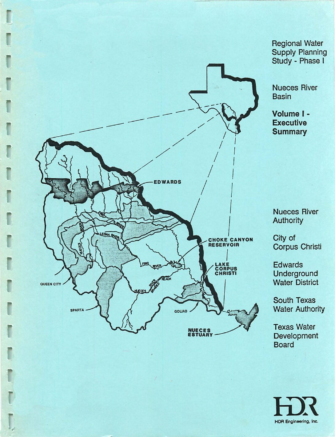
Regional Water Supply Planning Study Phase I Nueces River Basin Volume I Executive Summary
Description: Note: This report is included for its historical value and may have been replaced by more recent studies. Executive Summary of 1991 water supply plan for the Nueces River Basin emphasizing construction of recharge structures (dams and reservoirs)
Location: Nueces River Basin
Summary:Note: This report is included because of its historical value and may have been replaced by more recent plans.
[From the Executive Summary]
The study area consists primarily of the Nueces River Basin, which covers an area of approximately 17,000 square miles in South Texas as shown in Figure ES-1. Several entities interested in the potential development of additional water supplies in the basin, along with the Texas Water Development Board (TWDB), have jointly participated in the performance of this study. These four entities are: Nueces River Authority (Authority); City of Corpus Christi; Edwards Underground Water District (EUWD); and South Texas Water Authority (STW A).
Over the past several decades, increasing water demands on the Edwards Aquifer have raised concerns about the ability of the aquifer to meet these demands without causing social, economic, and environmental problems. The headwaters of the Nueces River Basin contribute about 57 percent of the total volume of surface water recharge to the San Antonio portion of the Edwards Aquifer. Streams crossing the Edwards Aquifer recharge zone lose a significant portion of their flow through faults and solution cavities in the limestone formations. A large portion of the runoff from the headwater area, however, occurs during storms which exceed the capacity of the recharge zone. It has been suggested that, if recharge enhancement structures were constructed, aquifer water levels, well yields, and springflows would benefit.
The concept of building recharge structures is not new. In 1964, the U.S. Army Corps of Engineers (COE) identified numerous potential sites for recharge projects.[See Volumes 1-3 of Survey Report on Edwards Underground Reservoir Guadalupe, San Antonio and Nueces Rivers and Tributaries, Texas.) Since 1974, the Edwards Underground Water District has undertaken the construction of three small recharge projects in the basin. The locations of the EUWD recharge projects as well as the locations of those projects identified by the COE (and others) are shown in Figure ES-1.
Approximately 98 percent of the drainage area of the Nueces River basin is located upstream of the Choke Canyon Reservoir/Lake Corpus Christi System (CC/LCC System). The locations of these two reservoirs are shown in Figure ES-1. The CC/LCC System is operated by the City of Corpus Christi, with the majority of water being diverted from the system at the Calallen Diversion Dam located 35 miles downstream of Lake Corpus Christi.
At this location, the water is diverted from the river and distributed to various municipal and industrial users. The CC/LCC System is the primary source of municipal and industrial water supply for a significant portion of the Texas Coastal Bend. Reductions in the inflows to these two reservoirs that could result from the construction of additional recharge projects is an important consideration in the evaluation of any recharge program.
Ongoing studies of the Nueces Estuary, which include Nueces, Corpus Christi, Oso, and Redfish Bays and a portion of the Laguna Madre, by the Texas Water Development Board (and others) have shown that freshwater inflows play an important role in the productivity and viability of the estuary. Reduction of inflow to the Nueces Estuary that could result from the construction of additional recharge structures is also an important consideration.
The primary objectives of this study are listed below and were accomplished through the development and application of a computer model of the Nueces River Basin.
*Determine the potential for increasing artificial recharge to the Edwards Aquifer through construction of additional recharge structures in the Nueces River Basin;
*Calculate the firm yield of the Choke Canyon Reservoir /Lake Corpus Christi System with and without additional recharge structures; and
*Quantify the potential impacts of additional recharge structures on inflows to the Nueces Estuary.
Additional objectives of the study included:
*Independent evaluation of U.S. Geological Survey (USGS) estimates of historical natural recharge to the Edwards Aquifer from the Nueces River Basin;
*Estimation of future water demands for the Nueces River Basin through the year 2040 with emphasis on estimating future demands of the CC/LCC service area;
*Evaluation of the firm yield of the CC/LCC System with respect to its ability to meet future demands through the year 2040; and
*Development of recommendations for additional study.
Significant study findings and conclusions are as follows:
*Historical recharge to the Nueces River Basin portion of the Edwards Aquifer can be increased by an average of about 85,300 ac-ft per year if all seven Type 1 recharge structures are constructed and all water rights are honored. This represents an increase of about 26.3 percent in the historical average recharge to the Nueces River Basin portion of the Edwards Aquifer from surface water sources. Recharge during the 10-year drought period from 1947 through 1956 could be increased by about 19,100 ac-ft per year or 12.3 percent of the historical average during this 10-year period.
*Recharge with all twelve Type 2 recharge structures in place can be increased.on the average .by about 61,100 ac-ft per year or 18.9 percent if ·all water rights are honored. For the 1947-1956 drought period, recharge could be increased by about 24,100 ac-ft per year or 15.5 percent
*The recharge estimates in this report represent a theoretical maximum and are subject to significant reductions due to likely economic, environmental, structural, and political limitations on more detailed review.
*With no additional recharge structures in place, the firm yield of the CC/LCC System under Phase IV operating policy is 220,000 ac-ft per year for 1990 conditions and 197,500 ac-ft per year for 2040 conditions. These yields are based on existing water rights diverting at full authorization and do not consider the full release of 151,000 ac-ft per year to the Nueces Estuary. If system releases needed to insure 151,000 ac-ft of annual estuarine inflows are made, without abeyance provisions for drought conditions, then the 1990 firm yield is 166,300 ac-ft per year and the 2040 firm yield is 147,300 ac-ft per year.
*With no additional recharge structures in place, the firm yield of the CC/LCC System under Phase II operating policy is 187,800 ac-ft per year for 1990 conditions and 169,700 ac-ft per year for 2040 conditions. These ·yields are based on existing water rights diverting at full authorization and do not consider the full release of 151,000 ac-ft per year to the Nueces Estuary. If system releases needed to insure 151,000 ac-ft of annual estuarine inflows are made, without abeyance provisions for drought conditions, then the 1990 firm yield is 122,400 ac-ft per year and the 2040 firm yield is 107,100 ac-ft per year.
*The 1990 firm yield of the CC/LCC System would be reduced by up to 3,900 ac-ft ·per year with the implementation of all seven Type 1 recharge structures, if these structures were operated not to honor the water rights of the CC/LCC System.
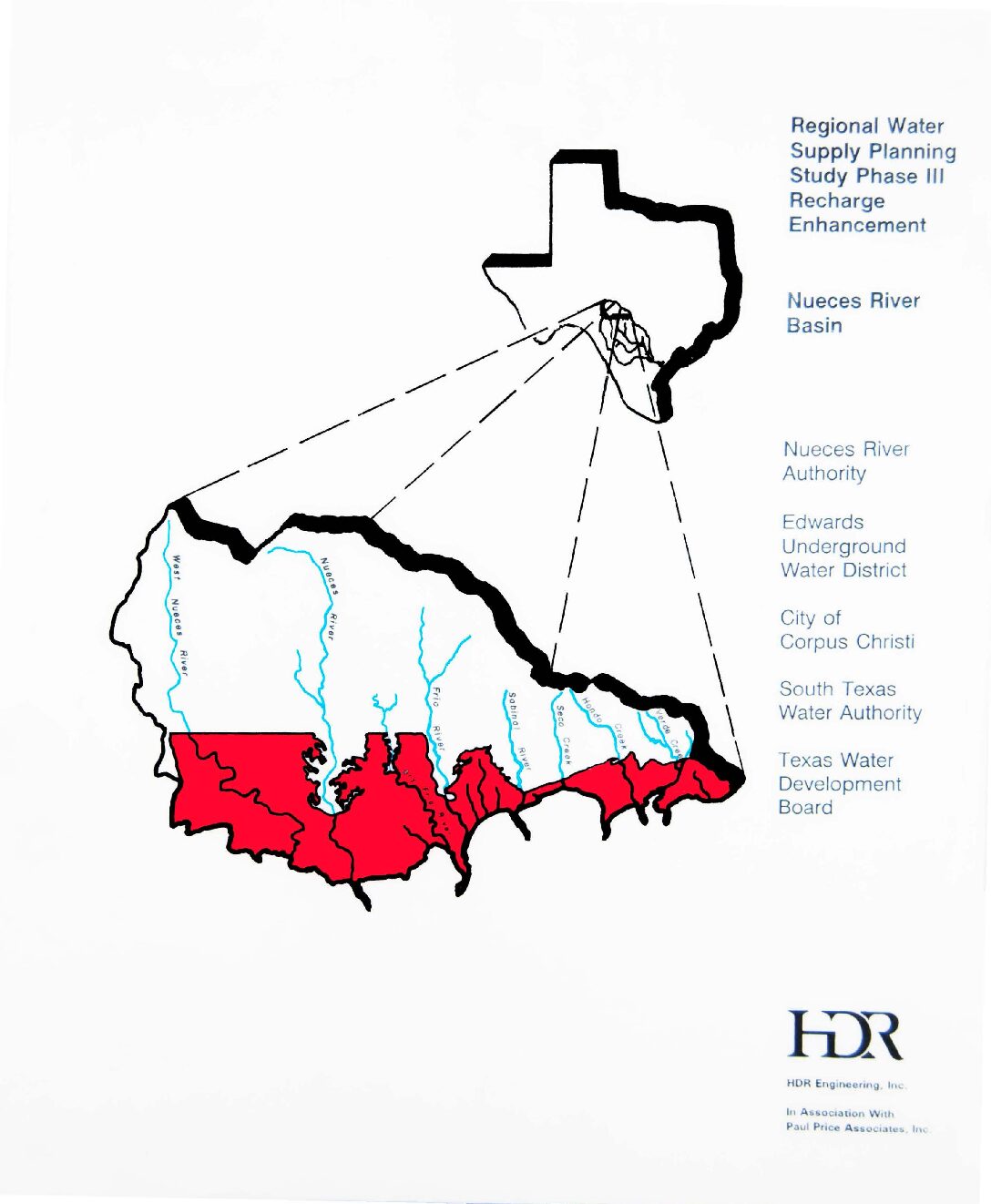
Regional Water Supply Planning Study Phase III-Recharge Enhancement-Nueces River Basin
Description: Analysis of nineteen proposed recharge structures for the Nueces River Basin with respect to cost and environmental concerns. Note: This document was included for its historical value but may have been superseded by more recent studies.
Location: Nueces River Basin
Summary:Note: This document was included for its historical value but may have been superseded by more recent studies.
The study area consists primarily of the Nueces River Basin, which covers an area of approximately 17,000 square miles in South Texas. Several entities interested in the potential effects and costs of developing additional recharge enhancement structures, along with the Texas Water Development Board (TWDB), have jointly participated in the performance of this study. These four entities are:
Nueces River Authority (Authority);
Edwards Underground Water District (EUWD);
City of Corpus Christi; and
South Texas Water Authority (STWA).
Over the past several decades, increasing water demands on the Edwards Aquifer have raised concerns about the ability of the aquifer to meet these demands without causing social, economic, and environmental problems. The headwaters of the Nueces River Basin contribute about 57% of the total volume of surface water recharged to the San Antonio portion of the Edwards Aquifer. Streams crossing the Edwards Aquifer recharge zone lose a significant portion of their flow through faults and solution cavities in the limestone formations. A large portion of the runoff from the headwater area, however, occurs during storms which exceed the natural recharge capability of the recharge zone. In this Phase III of the Nueces River Basin Regional Water Supply Planning Study, the 19 recharge enhancement reservoirs identified during Phase I have been evaluated with respect to cost and environmental concerns.
Survey Report on Edwards Underground Reservoir Guadalupe, San Antonio and Nueces Rivers and Tributaries, Texas. Volume 1 Main Report
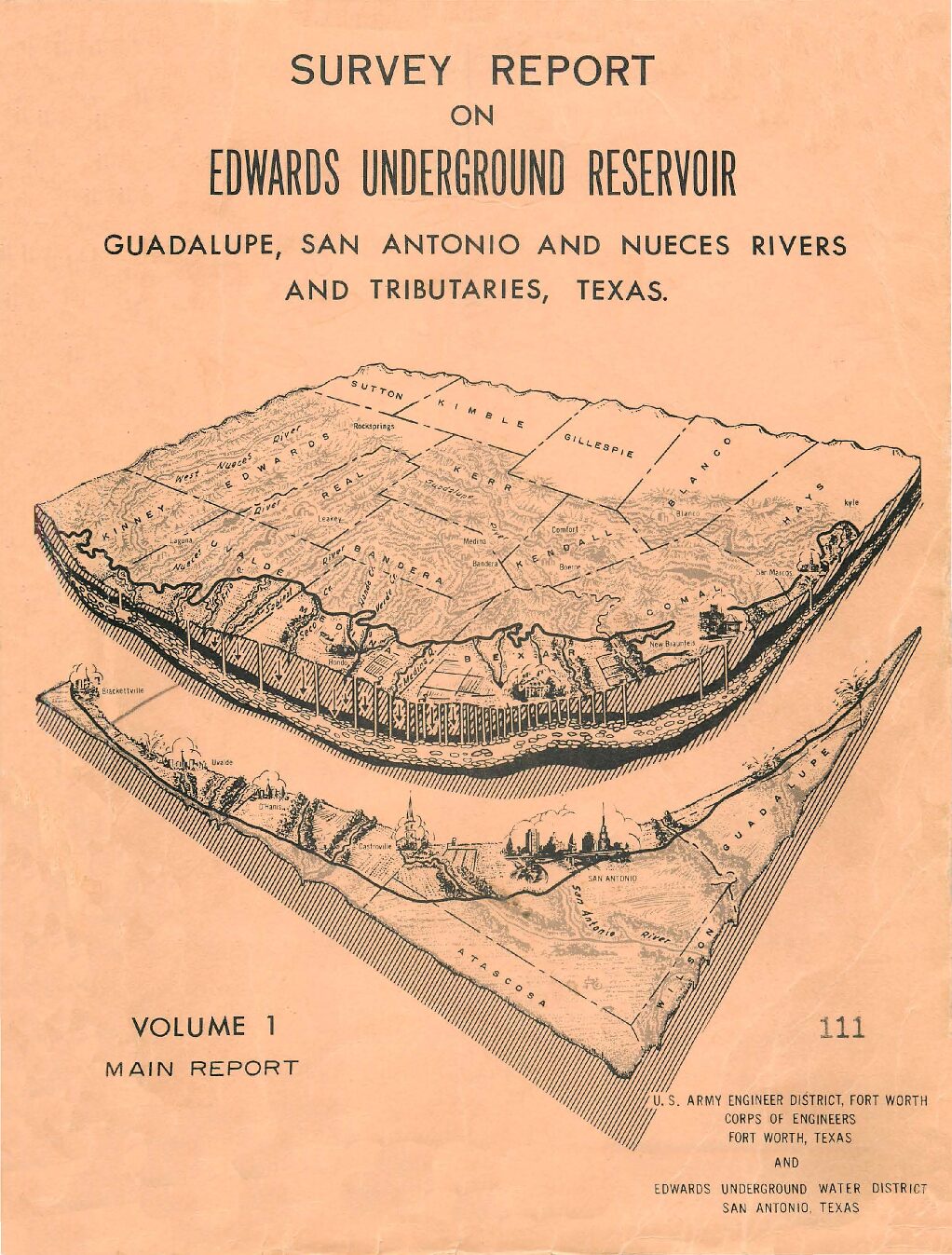
Description: Note: This report is included for its historical value and may have been replaced by more recent studies. Volume 1 of survey by the US Army Corps of Engineers and the Edwards Underground Water District, emphasizing possible locations for reservoirs and containment systems.
Location: Edwards Aquifer, Guadalupe River, San Antonio River, Nueces River
Summary:Note: This report is included for its historical value and may have been replaced by more recent studies. Volume 1 of survey by the US Army Corps of Engineers and the Edwards Underground Water District, emphasizing possible locations for reservoirs and containment systems.
Phase I Edwards Underground Water District Storage-Release Recharge Facility Evaluation
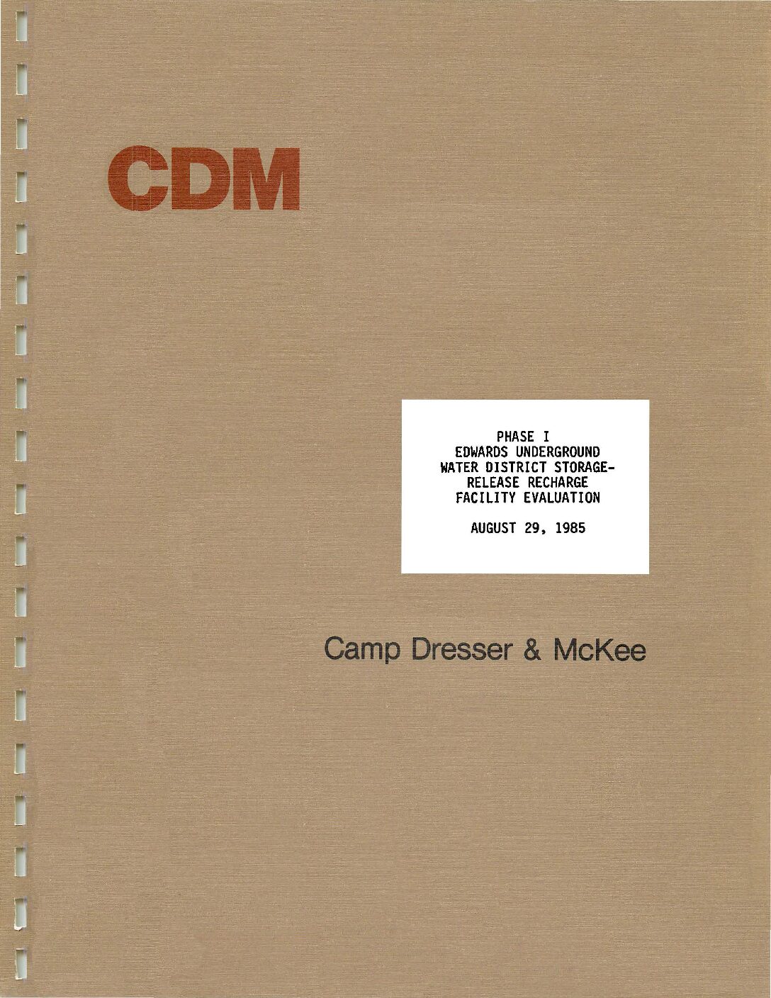
Description: Engineering and simulation study to evaluate two potential sites for storage/release reservoirs on the Frio and Dry Frio Rivers. Note: This report is included for its historical value and may have been replaced by more recent studies.
Summary:Engineering and simulation study to evaluate two potential sites for storage/release reservoirs on the Frio and Dry Frio Rivers.
Note: This report is included for its historical value and may have been replaced by more recent studies.
Strategic Plan 2002-2006
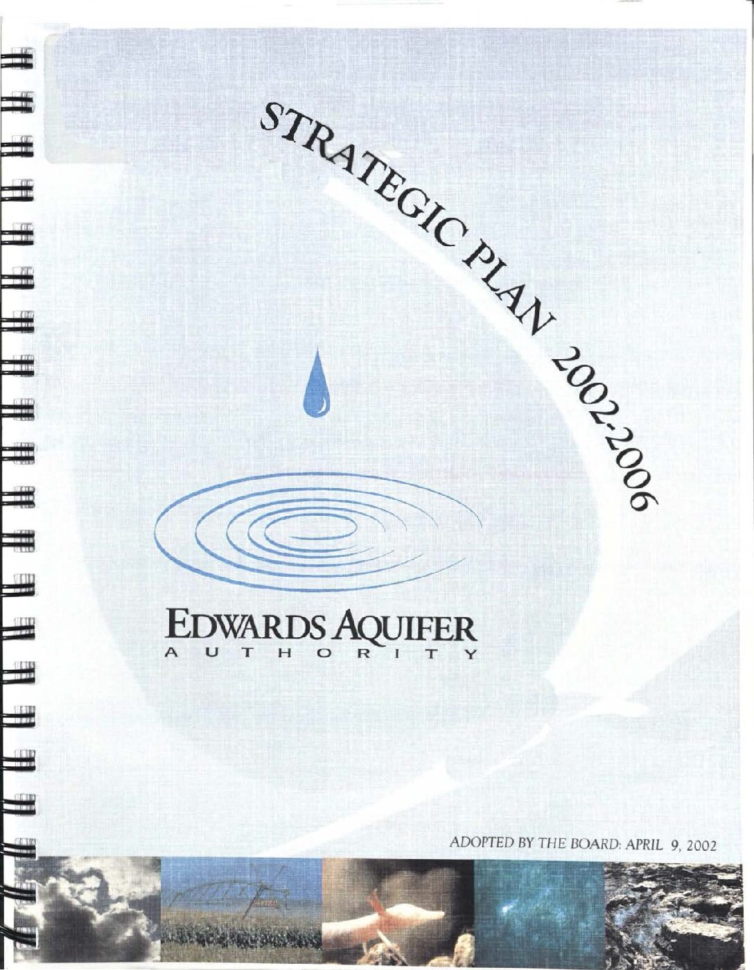
Description: Strategic Plan for the Authority in the period 2002-2006, including research plans. Note: This document was included for its historical value and has been superseded by more recent studies.
Location: Edwards Aquifer Authority Jurisdiction
Summary:Strategic Plan for the Authority in the period 2002-2006, including research plans.
Note: This document was included for its historical value and has been superseded by more recent ones.
South Central Texas Regional Water Planning Area 2001 Regional Water Plan Volume I Executive Summary and Regional Water Plan-Part 2
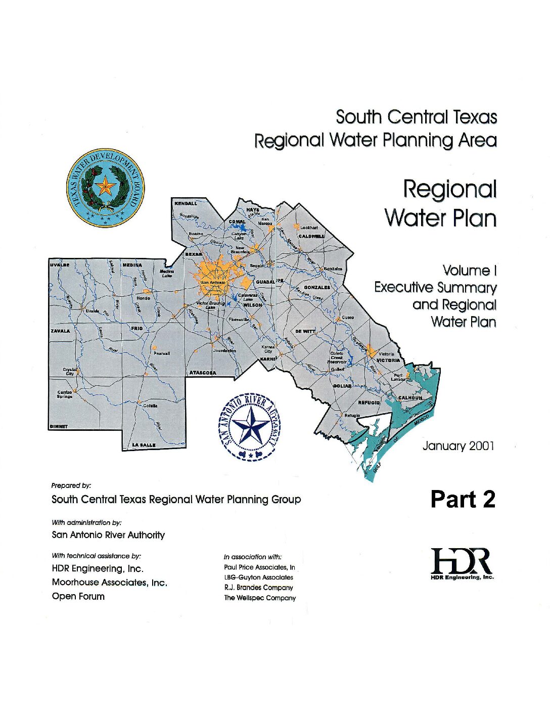
Description: Executive Summary and Water Plan for the 2001 South Central Texas Regional Water Plan Part 2. Note: This report is included for its historical value but was replaced by the 2006 South Central Texas Regional Water Plan, the 2011 South Central Texas Regional Water Plan, and eventually by the Texas Water Plan.
Location: South Central Texas
Summary:Note: This report is included because of its historical value and has been replaced by the Texas Water Plan. It covers in part the jurisdiction of the Edwards Aquifer Authority.
Table of Contents (Parts 1 and 2):
Executive Summary
- Description of Region
- Population and Water Demand Projections
- Evaluation of Current Water Supplies
- Comparison of Supply and Demand
- Regional, County, City, Water User Group, and Major Water Provider Plans
- Additional Recommendations/Conservatoin Guidelines
- Plan Adoption
Appendices
- Irrigation Projection Methodology
- General Procedures and Assumptions for Technical Evaluations
- Reliability Information for Water Rights in the South/Central Texas Region
South Central Texas Region 2000 Water Needs Assessment
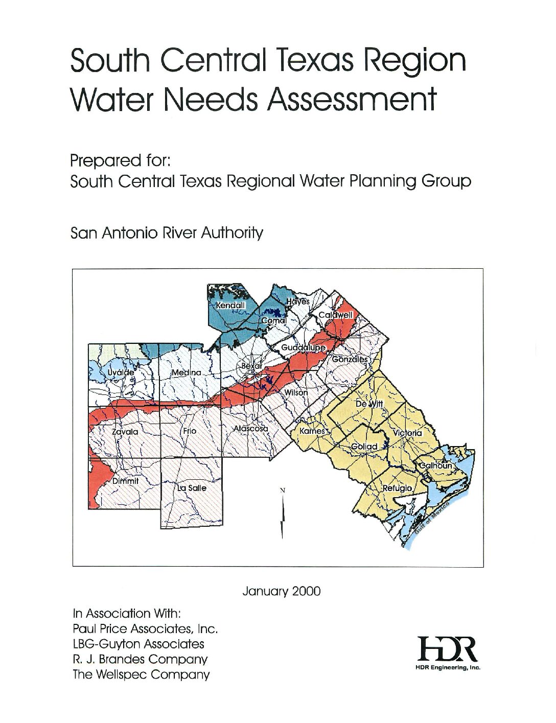
Description: Note: This report is included for historical value but has been replaced by the Texas Water Plan. Summaries of various sources of water, their costs, and projected needs of each county and jurisdiction by use.
Location: South Central Texas
Summary:This report is included for historical value but has been replaced by the Texas Water Plan. This is a series of graphical presentations of possible sources of water and their costs, along with projected needs of each county and jurisdiction through 2050. It covers in part the area served by the Edwards Aquifer Authority.
Trans-Texas Water Program West Central Study Area Integrated Resource Planning Committee Final Criteria Report Public Participation / Stakeholder Involvement Process
Description: Note: This report is included because of its possible historical value. It has been replaced by more recent plans. Input of public and stakeholders in the Trans-Texas Water Program West Central Study Area.
Location: West Central Texas
Summary:Note: This report is included because of its possible historical value. It has been replaced by more recent plans.
The Trans-Texas Water Program was initiated as a regional water planning process by the Texas Water Development Board to identify the most cost-effective and environmentally sensitive strategies for meeting the current and future water needs of southeast, south-central, west-central and north-central Texas. Each of these areas was designated as a study region. This report relates to the West Central Study Area of the Trans-Texas Water Program which was formed in 1993 (see map of study region, p. 3.). The West Central Study Area comprises thirty-two (32) counties west of the Brazos River and includes the Guadalupe-Blanco, San Antonio and Lower Colorado River basins, part of the Nueces River basin, the Edwards Aquifer and part of the Carrizo-Wilcox Aquifer.
Initially, the program was to be carried out in three phases: 1) Program Initiation/Conceptual Planning; 2) Feasibility Studies; and 3) Implementation. The Senate Bill 1 process superseded the Trans-Texas Water Program process and consequently, feasibility studies and the implementation phases were not completed.
Committee Conclusions
Water Resource Evaluation Criteria
The Water Resource Evaluation Criteria listed below were the result of the deliberations of the Integrated Resource Planning Committee over the period of its existence. As agreed to by the committee and the PMC for the West Central Study Area, these criteria will be submitted to the Texas Water Development Board as part of the record of work accomplished by the Trans-Texas Water Program for this study area. They are intended for use by water planners as they evaluate the various alternatives to meet the water needs of their region. The criteria would be employed by asking how well an alternative achieves the following objectives:
Economic
*Facilitates economic development
*Minimizes long range negative socio-economic impacts (including loss of tax base)
*Promotes opportunities for cost sharing and economic partnership
*Provides cost effective solutions
Water Quality
*Provides and maintains appropriate water quality for the intended use
Fairness
*Maximizes efficient use of water in areas that import water
*Promotes equitable distribution of costs in meeting region's water needs
Feasibility
*Demonstrates feasibility in terms of timing, technical, scientific, economic, political, regulatory, legal, and public acceptance factors
Efficiency
*Minimizes evaporative and distribution losses
*Promotes conservation
*Promotes conjunctive use
Flexibility
*Adaptable to new and innovative technology
*Adaptable to changes in demand projections
*Adaptable to changes in law
*Adaptable to future supply options
Compatibility
*Maximizes regional compatibility with local water plans
*Minimizes negative impacts on property rights
*Maximizes consistency with local growth management plans
*Maximizes compatibility with plans from surrounding regions
Reliability
*Maximizes a sustainable (referring to yield) supply of water for short-term and long-term needs
*Minimizes interruptions to water supplies
Environment
*Minimizes short-term and long-term negative impacts on natural resources
¢Wildlife/habitat
*Rivers
*Bays
¢ Estuaries
¢ Lakes
*Aquifers
*Karsts
*Air quality
*Water quality
¢ Wetlands
*Minimizes short-term and long-term negative impacts to the human environment
*Recreational
*Cultural/historical
*Archeological
¢ Esthetics
Recommendations
The IRPC agreed on the following recommendations with the intention of providing more guidance to water planners to assure better regional water planning. The IR.PC wanted to emphasize the need for water planners to take into account the indirect impact of their actions and decisions as well as their direct impact. The recommendations were:
*Public participation and education should continue to be an integral part of a regional water planning process.
*When evaluating alternatives, ensure that indirect impacts such as growth inducing or inhibiting effects are considered.


